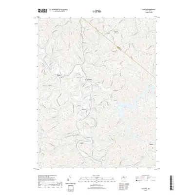
2019 Map of Lavalette
USGS Topo · Published 2019About this map
Twelvepole Creek winds through the heart of this West Virginia landscape, anchoring a string of small communities from Shoals and Lavalette down to the town of Wayne. The map illustrates the rugged topography typical of the region, where narrow valleys dictate the paths of secondary roads like 5th Street Rd and Camp Creek Rd. Significant for local historians, numerous family and community burial sites are documented across the hillsides, including the Stephenson Family Cem and Luther Bowen Cem. The eastern portion of the area is dominated by the sprawling waters of Beech Fork Lake, with its many fingers like Stowers Br and Falls Br reaching into the hollows. This 2019 survey provides a contemporary view of the intersection between established settlements like Dickson and the enduring natural features of the Cabell and Wayne county line.
Find a feature on this map
136 named features on this map. Tap any name to fly to it.
Don’t see what you’re looking for? This feature index may not catch every label — zoom into the map to look around manually.
Map Details
Editions of this 2019 Lavalette Map
This is the sole edition of this map. No revisions or reprints were ever made.
Other maps of this area

1892 · Huntington
USGS Topo · 1:125,000

1898 · Huntington
USGS Topo · 1:125,000

1901 · Guyandot
USGS Topo · 1:62,500

1901 · Ceredo
USGS Topo · 1:62,500

1902 · Guyandot
USGS Topo · 1:62,500

1903 · Kenova
USGS Topo · 1:125,000

1904 · Kenova
USGS Topo · 1:125,000

1909 · Wayne
USGS Topo · 1:62,500

1911 · Louisa
USGS Topo · 1:48,000

1913 · Ceredo
USGS Topo · 1:62,500