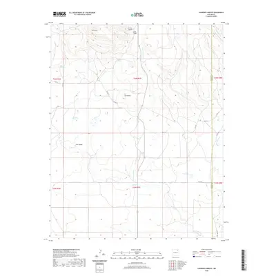
2020 Map of Lawrence Arroyo
USGS Topo · Published 2020About this map
Lawrence Arroyo carves through the high plains of Union County, defining a landscape shaped by intermittent water and early ranching infrastructure. Named springs such as Barela Spring, Horseshoe Spring, and the high-elevation Ojo de Llano indicate the critical importance of reliable water sources in this arid territory. The terrain is marked by distinct geological formations like the Chico Hills and Las Mesetas, which overlook a network of county roads including Romero Rd and Chico Rd.
Find a feature on this map
30 named features on this map. Tap any name to fly to it.
Don’t see what you’re looking for? This feature index may not catch every label — zoom into the map to look around manually.
Map Details
Editions of this 2020 Lawrence Arroyo Map
This is the sole edition of this map. No revisions or reprints were ever made.
Other maps of this area

1954 · Raton
USGS Topo · 1:250,000

1954 · Dalhart
USGS Topo · 1:250,000

1958 · Raton
USGS Topo · 1:250,000

1958 · Dalhart
USGS Topo · 1:250,000

1962 · Dalhart
USGS Topo · 1:250,000

1971 · Pine Buttes
USGS Topo · 1:24,000

1971 · Palo Blanco Mountain
USGS Topo · 1:24,000

1972 · Malpie Mountain
USGS Topo · 1:24,000

1973 · Gladstone NW
USGS Topo · 1:24,000

1974 · Point Of Rocks Mesa
USGS Topo · 1:24,000