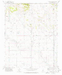
1974 Map of Lawrence Arroyo
USGS Topo · Published 1978About this map
The Santa Fe Trail and its significant Cimarron Cutoff cross this high plains landscape, marking the historic movement of traders and migrants through Colfax County. This 1970s survey captures a working ranching environment defined by scattered water sources like Barela Springs and Laird Springs. The infrastructure of the era is represented by family-named landmarks such as the Archuleta Windmill, Reville Windmill, and Tafoya Windmill, which highlight the necessity of groundwater management in the shadow of the Chico Hills. Notable for genealogists is a lone Grave located north of the Lawrence Arroyo, a poignant reminder of the individuals who lived in this arid territory. The geography is further defined by the winding paths of Holkeo Creek and Palo Blanco Creek, providing a detailed view of the drainage patterns essential to the regional cattle industry.
Find a feature on this map
31 named features on this map. Tap any name to fly to it.
Don’t see what you’re looking for? This feature index may not catch every label — zoom into the map to look around manually.
Map Details
Editions of this 1974 Lawrence Arroyo Map
This is the sole edition of this map. No revisions or reprints were ever made.
Other maps of this area

1954 · Raton
USGS Topo · 1:250,000

1954 · Dalhart
USGS Topo · 1:250,000

1958 · Raton
USGS Topo · 1:250,000

1958 · Dalhart
USGS Topo · 1:250,000

1962 · Dalhart
USGS Topo · 1:250,000

1971 · Pine Buttes
USGS Topo · 1:24,000

1971 · Palo Blanco Mountain
USGS Topo · 1:24,000

1972 · Malpie Mountain
USGS Topo · 1:24,000

1973 · Gladstone NW
USGS Topo · 1:24,000

1974 · Point Of Rocks Mesa
USGS Topo · 1:24,000