2023 Map of Lawrence
USGS Topo · Published 2023About this map
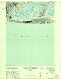
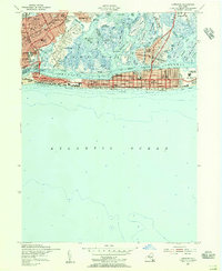
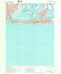
The dense coastal settlements of Inwood, Cedarhurst, and Lawrence dominate this corner of Nassau County, where the grid of New York meets the barrier island geography of the Atlantic coast. This modern survey illustrates the complex relationship between land and water across Hempstead Bay, featuring a network of tidal channels like Reynolds Channel and Wreck Lead Channel that separate Long Island from its outlying communities. The landscape is a mix of tight residential blocks and ecological features such as Lawrence Marsh and North Meadow. Prominent local institutions are documented here, including the Rabbinical College of Long Island in Long Beach and the Shor Yoshuv Institute. For those tracing local history, the map provides precise locations for Saint Marys and the Long Island Cem, while showing the continued importance of the Long Island railroad lines that serve these south shore villages.
Find a feature on this map
208 named features on this map. Tap any name to fly to it.
Don’t see what you’re looking for? This feature index may not catch every label — zoom into the map to look around manually.
Map Details
Editions of this 2023 Lawrence Map
This is the sole edition of this map. No revisions or reprints were ever made.
Historical Maps of East Atlantic Beach Through Time
4 maps found