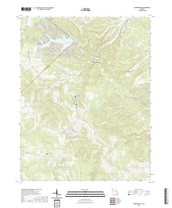
2021 Map of Lawrenceton
USGS Topo · Published 2021About this map
Lawrenceton sits at the heart of this landscape, situated near Pinhook Hollow and the winding course of Fourche a Du Clos. To the northwest, the residential development surrounding Goose Creek Lake represents a modern contrast to the surrounding terrain of Pine Ridge and Siebert Bottom Hollow. The area is notably dense with small family and parish burial sites, such as the Patterson Family Cem, Bequette Cem, and Saint Lawrence Cem, which provide significant geographic clues for genealogists and local researchers. The landscape is defined by the headwaters of several streams, including Terre Bleue Cr and Establishment Cr, which drain the ridges along the St. Francois and Ste. Genevieve county line. This distribution of rural cemeteries and remote church sites like Little Vine Church Cem reflects the established family footprints in this portion of the Missouri Ozarks.
Find a feature on this map
102 named features on this map. Tap any name to fly to it.
Don’t see what you’re looking for? This feature index may not catch every label — zoom into the map to look around manually.
Map Details
Editions of this 2021 Lawrenceton Map
This is the sole edition of this map. No revisions or reprints were ever made.
Other maps of this area

1904 · Farmington
USGS Topo · 1:62,500

1906 · Farmington
USGS Topo · 1:62,500

1907 · Weingarten
USGS Topo · 1:62,500

1909 · Weingarten
USGS Topo · 1:62,500

1915 · Renault
USGS Topo · 1:62,500

1915 · Crystal City
USGS Topo · 1:62,500

1940 · Renault
USGS Topo · 1:62,500

1949 · Saint Louis
USGS Topo · 1:250,000

1949 · Rolla
USGS Topo · 1:250,000

1949 · Crystal City
USGS Topo · 1:62,500