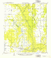
1954 Map of Le Blanc
USGS Topo · Published 1954About this map
Whisky Chitto Creek meanders through the heart of this landscape, its winding course defining the southern Louisiana terrain as it moves toward its junction with the Calcasieu River. The map reveals a transition in transportation and land use during the mid-1930s, when field examinations were conducted. The small settlement of Le Blanc sits at a critical infrastructure point where the New Orleans Texas and Mexico and Missouri Pacific rail lines converge, highlighting the importance of timber and freight movement in the era.
Find a feature on this map
17 named features on this map. Tap any name to fly to it.
Don’t see what you’re looking for? This feature index may not catch every label — zoom into the map to look around manually.
Map Details
Editions of this 1954 Le Blanc Map
This is the sole edition of this map. No revisions or reprints were ever made.
Other maps of this area

1935 · Mittie
USGS Topo · 1:31,680

1947 · Kinder
USGS Topo · 1:31,680

1947 · Oberlin
USGS Topo · 1:31,680

1947 · Pine Chapel
USGS Topo · 1:31,680

1947 · Le Blanc
USGS Topo · 1:31,680

1947 · Edna
USGS Topo · 1:31,680

1947 · Reeves
USGS Topo · 1:31,680

1947 · Thompson Bluff
USGS Topo · 1:31,680

1947 · Bundick
USGS Topo · 1:31,680
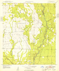
1948 · Mittie
USGS Topo · 1:24,000