Old Maps of Allen Parish, Louisiana
Explore 213 old maps of Allen Parish, spanning from 1935 to today. These high-resolution historic maps reveal how streets, neighborhoods, landmarks, and natural features evolved over time — perfect for genealogy, metal detecting, research, and local history exploration.
What you can do with these maps:
- See how Allen Parish changed over time: Compare historical maps to modern-day views to trace roads, homesites, rail lines & more.
- View detailed metadata: Each map includes creators, publishers, year, scale, and archive source.
- Overlay maps with satellite & LiDAR: Visualize the past alongside modern tools to explore terrain & human change.
- Trusted historical sources: Maps sourced from the USGS, Library of Congress, and other archives.
- Access maps your way: View online, download high-res files, or order prints for personal or research use.
Start exploring old maps of Allen Parish to uncover forgotten places, hidden landmarks, and the deep history beneath your feet.
Allen Parish, LA maps
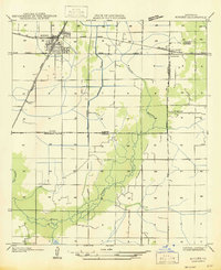
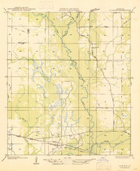
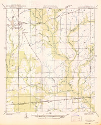
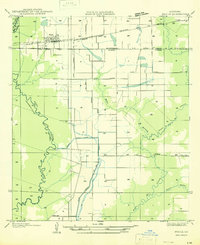
(213)- 1935 Map of Beaver
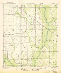
 1935 Beaver1935 Print · USGSEvangeline Parish is captured here during the mid-1930s as the era of heavy timber harvesting leaves its mark on the land. Researchers can trace the sprawling Old Logging Railroad Grade and locate old gathering places like Cypress Creek Settlement and the Beaver Sch.
 - 1935 Map of Mittie
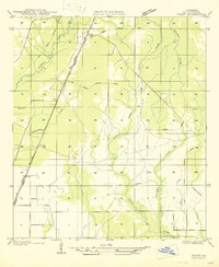
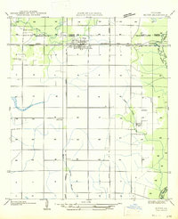
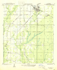
 1935 Mittie1935 Print · USGSAllen Parish was a landscape in transition during the mid-1930s as timber rail lines gave way to new state highways. Genealogists and local historians can trace the foundations of Mittie and Simmons Settlement alongside the Cherry Grove Ch and an Old Logging Railroad Grade.
 - 1935 Map of Pawnee
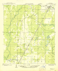
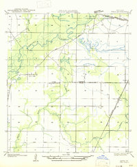
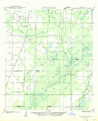
 1935 Pawnee1935 Print · USGSCentral Louisiana's timber country is captured in the mid-1930s, showing the early infrastructure of the Rapides and Allen parish line. Researchers can trace the Logging Railroad and locate vanished landmarks like the Union Hill Sch and Bethel Cem.
 - 1935 Map of Gaytine
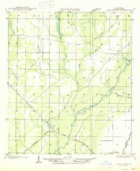
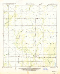
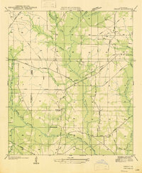
 1935 Gaytine1935 Print · USGSSouthwestern Louisiana's wetlands and timber country are captured here in the mid-1930s as the logging era left its mark on the landscape. Researchers can trace old industrial footprints through the Old Logging Railroad Grade and find small communities like Gaytine and Turps.
 - 1935 Map of Oakdale
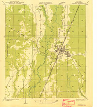 1935 Oakdale1935 Print · USGSOakdale emerges as a bustling railroad and timber hub in the mid-1930s, situated at the intersection of major rail lines and local logging routes. Genealogists and historians can trace the Oakdale townsite, the Oak Hill Ch, and the extensive Logging Railroad networks that powered the regional economy.
 - 1935 Map of Longville
 1935 Longville1935 Print · USGSLouisiana's timber country comes to life in the 1930s as logging railroads and spurs weave through the forests of Beauregard and Allen Parishes. Researchers can trace the development of Longville and find local landmarks like Center Ridge Ch and Kernan Sch.
 - 1942 Map of Oakdale, 1964 Print
 1942 Oakdale1964 Print · USGSCentral Louisiana's timber and rail country comes to life in the early 1940s as the Calcasieu River winds through Oakdale and Glenmora. Genealogists can trace family roots through landmarks like Hargrove Farm, Cryer Cem, and Cypress Creek Settlement.
 - 1947 Map of Gaytine
 1947 Gaytine1947 Print · USGSLouisiana's bayou country is captured in the mid-1930s as the timber and rail era left its mark across Beauregard Parish. Researchers can trace the path of the Southern Pacific and the Old Logging Railroad Grade near Gaytine and Turps.
 - 1947 Map of Kinder
 1947 Kinder1947 Print · USGSThe rail junction at Kinder during the mid-1930s serves as the heart of this survey of the Allen and Jefferson Davis parish line. Genealogists and researchers can trace local settlements and rail sidings like Rodgerville, Lauderdale, and Coverdale Sta.
 - 1947 Map of Fruge Lake
 1947 Fruge Lake1947 Print · USGSThe Louisiana bayou country during the mid-1930s reveals a transition from timber harvesting to rural settlement along the Allen and Evangeline Parish line. Genealogists and local historians can pinpoint family landmarks like Veillon Sch, Valentine Sch, and the Old Logging Railroad Grade.
 - 1947 Map of Foley
 1947 Foley1947 Print · USGSAllen Parish during the mid-1930s and 40s shows a landscape in transition from timber extraction to permanent settlement. Researchers can trace the Old Logging Railroad Grades and locate family landmarks like Pine Sch and Foley.
 - 1947 Map of Oberlin
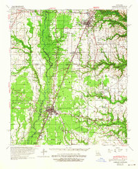
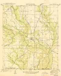
 1947 Oberlin1947 Print · USGSOberlin and the surrounding Allen Parish countryside are shown here in the late 1930s and 40s during a period of transition for the local timber industry. Researchers can trace rural family sites near Bethany Ch or follow the path of the Missouri Pacific Railroad through Moeling and Lyles.
 - 1947 Map of Steep Gully
 1947 Steep Gully1947 Print · USGSLouisiana timber and rail history converge here in the mid-1930s at the junction of Vernon, Rapides, and Allen parishes. Researchers can trace the legacy of logging via the old logging railroad grades or locate family sites at Tenmile Cem and Occupy Sch.
 - 1947 Map of Pine Chapel
 1947 Pine Chapel1947 Print · USGSAllen Parish is shown in the mid-1940s as the regional timber industry left its mark on the land near the Calcasieu River. Researchers can trace the legacy of local logging via the Old Logging Railroad Grade and locate old homesites in Oberlin or Pine Chapel.
 - 1947 Map of Le Blanc
 1947 Le Blanc1947 Print · USGSSouthwestern Louisiana's wetland and timber country is captured here during the mid-1940s. Trace family roots at Le Blanc or Harmony Ch, and follow the path of the Old Logging Railroad Grade through the Calcasieu River basin.
 - 1947 Map of Elton
 1947 Elton1947 Print · USGSJefferson Davis Parish was a landscape of rail-dependent farming communities in the late 1940s. Genealogists and local historians can locate rural landmarks such as China Cem, Fusilier Sch, and the small settlement of Wilburton.
 - 1947 Map of Edna
 1947 Edna1947 Print · USGSSouthwest Louisiana in the mid-1930s is a landscape of shifting bayous and expanding rail lines. Genealogists and historians can trace the early footprints of Indian Village, the community of Edna, and remnants of the Old Logging Railroad Grade.
 - 1947 Map of Reeves
 1947 Reeves1947 Print · USGSAllen Parish and the surrounding piney woods come into focus during the late 1940s, highlighting the area's transition from timber territory to a rail-connected hub. Researchers can trace the path of the Old Logging Railroad Grade near the settlements of Bel and Reeves.
 - 1947 Map of Bond
 1947 Bond1947 Print · USGSEvangeline and Allen Parishes are shown during the mid-1940s, highlighting a landscape transitioning from heavy timber production to rural agricultural life. Researchers can trace the Old Logging Railroad Grade and locate early schools like High Point Sch and Johnson Cove Sch.
 - 1947 Map of Longville
 1947 Longville1947 Print · USGSThe timber-rich corridor of Beauregard Parish is captured here during the 1930s, when logging infrastructure and rural rail spurs defined the local economy. Genealogists and historians can trace family locations near Longville, Magnolia Ch, and the Kernan Sch.
 - 1947 Map of Elizabeth
 1947 Elizabeth1947 Print · USGSAllen Parish was a center of the timber industry in the mid-1940s, shown here through an extensive network of timber spurs and mainline rail. You can trace early family sites at Turner Cem, the small rail settlement of Mab, and the industrial layout of Elizabeth.
 - 1947 Map of Thompson Bluff
 1947 Thompson Bluff1947 Print · USGSSouthwestern Louisiana's timber and river country is captured here during the late 1930s and 1940s. Researchers can trace the winding Calcasieu River and locate historic rural landmarks like Barnes Creek Ch and the Thompson Sch.
 - 1947 Map of Grant
 1947 Grant1947 Print · USGSAllen Parish and Beauregard Parish were still heavily marked by timber industry infrastructure in the mid-1940s. Genealogists and historians can trace family locations near Grant, the Hamilton Cem, and rural centers like Fairview Sch or Palestine Ch.
 - 1947 Map of Basile
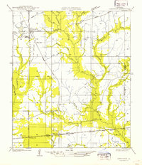
 1947 Basile1947 Print · USGSBasile and the surrounding Louisiana prairie are captured here in the late 1940s as the region's agricultural and rail networks were fully established. Researchers can trace family sites near Reed Cem and St Monica Ch, or follow the industrial waterworks of the Mamou Canal.
 - 1947 Map of Pitkin
 1947 Pitkin1947 Print · USGSVernon Parish at the end of the 1940s is a landscape of timber history and emerging highway networks. Trace genealogical roots through rural landmarks like Simmons Mill Ch or the tracks of the Gulf Colorado and Santa Fe Railroad near Pitkin.
Showing maps 1-25 of 213
Top cities of Allen Parish
- Oakdale historical maps
- Kinder historical maps
- Oberlin historical maps
- Elizabeth historical maps
- Reeves historical maps
Frequently asked questions
- What are the different types of historical maps available for Allen Parish?
- What is the oldest map of Allen Parish?
- Where can I purchase historical maps of Allen Parish for my home or office?
- Where can I download high-res historical maps of Allen Parish?
- Are there historical topographic maps available for Allen Parish?
- Is there historical aerial imagery available for Allen Parish?
- Where are historical maps of Allen Parish sourced from?