1940s Maps of Allen Parish, Louisiana
Explore 26 historic maps of Allen Parish from the 1940s. These maps offer a rare glimpse into what life looked like during the 1940s — showing old roads, neighborhoods, homes, and landmarks that have changed or disappeared over time.
Whether you're researching your family's past, planning a metal detecting trip, or studying how Allen Parish's landscape evolved across the 1940s, these high-resolution maps are a powerful tool for exploring the history of this region.
- Focus on a specific era: All maps on this page are from the 1940s, giving you a focused view of this time period.
- See what’s changed: Compare century-old streets, trails, and buildings to today's modern landscape using overlays and satellite layers.
- Research with precision: Use these maps for genealogy, historical research, land use analysis, or educational projects.
- View, download, or print: Maps are fully viewable online in high resolution, and can be downloaded or printed for your own records.
Start exploring Allen Parish's history through authentic maps from the 1940s. This is your window into the past.
Allen Parish, LA maps
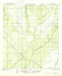
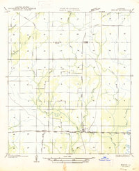
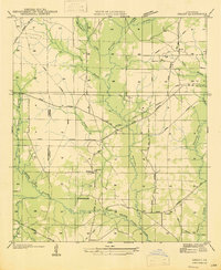
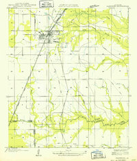
(26)- 1942 Map of Oakdale, 1964 Print
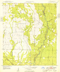
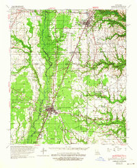 1942 Oakdale1964 Print · USGSCentral Louisiana's timber and rail country comes to life in the early 1940s as the Calcasieu River winds through Oakdale and Glenmora. Genealogists can trace family roots through landmarks like Hargrove Farm, Cryer Cem, and Cypress Creek Settlement.
 - 1947 Map of Gaytine
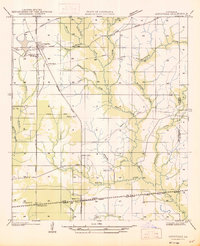
 1947 Gaytine1947 Print · USGSLouisiana's bayou country is captured in the mid-1930s as the timber and rail era left its mark across Beauregard Parish. Researchers can trace the path of the Southern Pacific and the Old Logging Railroad Grade near Gaytine and Turps.
 - 1947 Map of Kinder
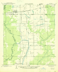
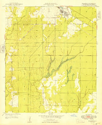
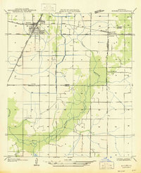 1947 Kinder1947 Print · USGSThe rail junction at Kinder during the mid-1930s serves as the heart of this survey of the Allen and Jefferson Davis parish line. Genealogists and researchers can trace local settlements and rail sidings like Rodgerville, Lauderdale, and Coverdale Sta.
 - 1947 Map of Fruge Lake
 1947 Fruge Lake1947 Print · USGSThe Louisiana bayou country during the mid-1930s reveals a transition from timber harvesting to rural settlement along the Allen and Evangeline Parish line. Genealogists and local historians can pinpoint family landmarks like Veillon Sch, Valentine Sch, and the Old Logging Railroad Grade.
 - 1947 Map of Foley
 1947 Foley1947 Print · USGSAllen Parish during the mid-1930s and 40s shows a landscape in transition from timber extraction to permanent settlement. Researchers can trace the Old Logging Railroad Grades and locate family landmarks like Pine Sch and Foley.
 - 1947 Map of Oberlin
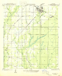
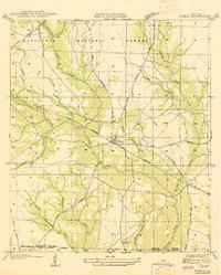
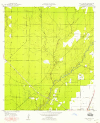
 1947 Oberlin1947 Print · USGSOberlin and the surrounding Allen Parish countryside are shown here in the late 1930s and 40s during a period of transition for the local timber industry. Researchers can trace rural family sites near Bethany Ch or follow the path of the Missouri Pacific Railroad through Moeling and Lyles.
 - 1947 Map of Steep Gully
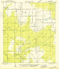
 1947 Steep Gully1947 Print · USGSLouisiana timber and rail history converge here in the mid-1930s at the junction of Vernon, Rapides, and Allen parishes. Researchers can trace the legacy of logging via the old logging railroad grades or locate family sites at Tenmile Cem and Occupy Sch.
 - 1947 Map of Pine Chapel
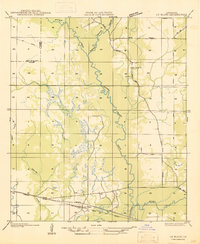
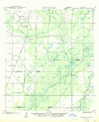
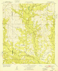
 1947 Pine Chapel1947 Print · USGSAllen Parish is shown in the mid-1940s as the regional timber industry left its mark on the land near the Calcasieu River. Researchers can trace the legacy of local logging via the Old Logging Railroad Grade and locate old homesites in Oberlin or Pine Chapel.
 - 1947 Map of Le Blanc
 1947 Le Blanc1947 Print · USGSSouthwestern Louisiana's wetland and timber country is captured here during the mid-1940s. Trace family roots at Le Blanc or Harmony Ch, and follow the path of the Old Logging Railroad Grade through the Calcasieu River basin.
 - 1947 Map of Elton
 1947 Elton1947 Print · USGSJefferson Davis Parish was a landscape of rail-dependent farming communities in the late 1940s. Genealogists and local historians can locate rural landmarks such as China Cem, Fusilier Sch, and the small settlement of Wilburton.
 - 1947 Map of Edna
 1947 Edna1947 Print · USGSSouthwest Louisiana in the mid-1930s is a landscape of shifting bayous and expanding rail lines. Genealogists and historians can trace the early footprints of Indian Village, the community of Edna, and remnants of the Old Logging Railroad Grade.
 - 1947 Map of Reeves
 1947 Reeves1947 Print · USGSAllen Parish and the surrounding piney woods come into focus during the late 1940s, highlighting the area's transition from timber territory to a rail-connected hub. Researchers can trace the path of the Old Logging Railroad Grade near the settlements of Bel and Reeves.
 - 1947 Map of Bond
 1947 Bond1947 Print · USGSEvangeline and Allen Parishes are shown during the mid-1940s, highlighting a landscape transitioning from heavy timber production to rural agricultural life. Researchers can trace the Old Logging Railroad Grade and locate early schools like High Point Sch and Johnson Cove Sch.
 - 1947 Map of Longville
 1947 Longville1947 Print · USGSThe timber-rich corridor of Beauregard Parish is captured here during the 1930s, when logging infrastructure and rural rail spurs defined the local economy. Genealogists and historians can trace family locations near Longville, Magnolia Ch, and the Kernan Sch.
 - 1947 Map of Elizabeth
 1947 Elizabeth1947 Print · USGSAllen Parish was a center of the timber industry in the mid-1940s, shown here through an extensive network of timber spurs and mainline rail. You can trace early family sites at Turner Cem, the small rail settlement of Mab, and the industrial layout of Elizabeth.
 - 1947 Map of Thompson Bluff
 1947 Thompson Bluff1947 Print · USGSSouthwestern Louisiana's timber and river country is captured here during the late 1930s and 1940s. Researchers can trace the winding Calcasieu River and locate historic rural landmarks like Barnes Creek Ch and the Thompson Sch.
 - 1947 Map of Grant
 1947 Grant1947 Print · USGSAllen Parish and Beauregard Parish were still heavily marked by timber industry infrastructure in the mid-1940s. Genealogists and historians can trace family locations near Grant, the Hamilton Cem, and rural centers like Fairview Sch or Palestine Ch.
 - 1947 Map of Basile
 1947 Basile1947 Print · USGSBasile and the surrounding Louisiana prairie are captured here in the late 1940s as the region's agricultural and rail networks were fully established. Researchers can trace family sites near Reed Cem and St Monica Ch, or follow the industrial waterworks of the Mamou Canal.
 - 1947 Map of Pitkin
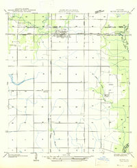
 1947 Pitkin1947 Print · USGSVernon Parish at the end of the 1940s is a landscape of timber history and emerging highway networks. Trace genealogical roots through rural landmarks like Simmons Mill Ch or the tracks of the Gulf Colorado and Santa Fe Railroad near Pitkin.
 - 1948 Map of Grant
 1948 Grant1948 Print · USGSThe Louisiana timberlands and parish borders are captured here in the late 1940s, highlighting the rural life of Fairview Grant. Genealogists can trace family heritage at Old Camp Ground Cem or locate the community at Palestine Mission Ch.
 - 1948 Map of Mittie
 1948 Mittie1948 Print · USGSAllen Parish in the post-war years was a landscape of winding creeks and quiet rural outposts. Genealogists and historians can trace family locations at Simmons Settlement, locate Simmons Cemetery, and follow the Old Railroad Grade through the woods.
 - 1948 Map of Elizabeth
 1948 Elizabeth1948 Print · USGSElizabeth and the surrounding Allen Parish timberlands are captured here in the late 1940s, just after the war. Researchers can trace the legacy of local industry along the Old Railroad Grade or locate family sites like Turner Cem and Turner Lookout.
 - 1948 Map of Pine Chapel
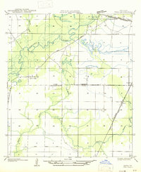
 1948 Pine Chapel1948 Print · USGSAllen Parish life in the late 1940s centers on the river and rail lines of the piney woods. Genealogists can locate family landmarks like Pine Chapel, Oakland Springs Ch, and the Oberlin Lookout during a period of steady rural growth.
 - 1949 Map of Bayou Blue
 1949 Bayou Blue1949 Print · USGSAllen Parish is shown in the late 1940s as a landscape shaped by timber history and tribal heritage. Researchers can trace the Old Logging Railroad Grade and locate local landmarks like the Coushatta Indian Sch and Sonnier Cem.
 - 1949 Map of Glenmora
 1949 Glenmora1949 Print · USGSCentral Louisiana's timber country comes to life in this mid-century survey of the Rapides Parish area. Genealogists and historians can trace the fading tracks of the Old Logging Railroad Grade and explore the early footprints of Glenmora and McNary.
Showing maps 1-25 of 26
Top cities of Allen Parish
- Oakdale historical maps
- Kinder historical maps
- Oberlin historical maps
- Elizabeth historical maps
- Reeves historical maps
Frequently asked questions
- What are the different types of historical maps available for Allen Parish?
- What is the oldest map of Allen Parish?
- Where can I purchase historical maps of Allen Parish for my home or office?
- Where can I download high-res historical maps of Allen Parish?
- Are there historical topographic maps available for Allen Parish?
- Is there historical aerial imagery available for Allen Parish?
- Where are historical maps of Allen Parish sourced from?