1990s Maps of Allen Parish, Louisiana
Explore 10 historic maps of Allen Parish from the 1990s. These maps offer a rare glimpse into what life looked like during the 1990s — showing old roads, neighborhoods, homes, and landmarks that have changed or disappeared over time.
Whether you're researching your family's past, planning a metal detecting trip, or studying how Allen Parish's landscape evolved across the 1990s, these high-resolution maps are a powerful tool for exploring the history of this region.
- Focus on a specific era: All maps on this page are from the 1990s, giving you a focused view of this time period.
- See what’s changed: Compare century-old streets, trails, and buildings to today's modern landscape using overlays and satellite layers.
- Research with precision: Use these maps for genealogy, historical research, land use analysis, or educational projects.
- View, download, or print: Maps are fully viewable online in high resolution, and can be downloaded or printed for your own records.
Start exploring Allen Parish's history through authentic maps from the 1990s. This is your window into the past.
Allen Parish, LA maps
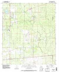
(10)- 1994 Map of Elton, 1996 Print
 1994 Elton1996 Print · USGSJefferson Davis Parish was a landscape of concentrated agriculture and emerging energy production in the mid-nineties. Genealogists and local historians can trace the grid of Elton, the smaller settlement of China, and the industrial Oil And Gas Field near Rogers Gully.
 - 1994 Map of Oberlin, 1996 Print
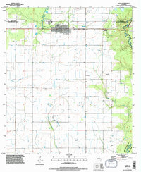
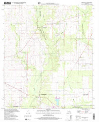
 1994 Oberlin1996 Print · USGSAllen Parish in the mid-nineties shows a rural landscape anchored by the Calcasieu River and the Coushatta Indian Res. Researchers can trace old railroad junctions at Elder and Le Jeune or locate family burial sites at various rural Cems.
 - 1994 Map of Le Blanc, 1996 Print
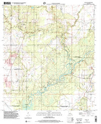
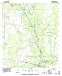 1994 Le Blanc1996 Print · USGSAllen Parish is defined by its winding waterways and rural settlements in the mid-1990s. Genealogists and local historians can trace the community of Le Blanc, locate a country Cem, and follow the confluence of Whisky Chitto Creek and the Calcasieu River.
 - 1994 Map of Kinder, 1996 Print
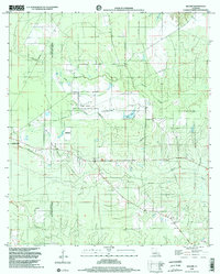
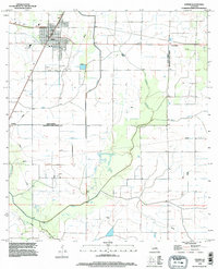 1994 Kinder1996 Print · USGSKinder and the surrounding prairie lands are captured here in the mid-1990s as the regional agricultural and transport network matured. Genealogists and local historians can trace the footprint of Kinder, the settlement at Lauderdale, and waterways like Bayou Serpent.
 - 1994 Map of Gaytine, 1996 Print
 1994 Gaytine1996 Print · USGSThe rural borders of Beauregard, Allen, and Calcasieu Parishes come together in the mid-1990s. Researchers can trace the local drainage along Indian Bayou and Marsh Bayou or locate small settlements like Gaytine and Turps.
 - 1994 Map of Longville, 1997 Print
 1994 Longville1997 Print · USGSThe piney woods of Beauregard Parish are captured in the mid-1990s as a landscape of gas infrastructure and rural crossroads. Genealogists and historians can locate small settlements like Edith and Burnett or trace the waters of Longville Lake.
 - 1997 Map of Steep Gully, 2001 Print
 1997 Steep Gully2001 Print · USGSThe rural pine woods and bayous of Central Louisiana come into focus in the late 1990s as several parish lines converge. Genealogists can trace family connections through sites like Tenmile Cem, Plainview Sch, and the uniquely named Occupy Ch No 1.
 - 1998 Map of Topsy, 2002 Print
 1998 Topsy2002 Print · USGSThe Calcasieu River lowlands at the turn of the millennium reveal a complex web of bayous and cutoffs where three Louisiana parishes meet. Researchers can trace rural lineages at Creel Cem or Nevils Cem and locate landmarks like Camp Pearl and Topsy.
 - 1998 Map of Beaver, 2002 Print
 1998 Beaver2002 Print · USGSThe Allen and Evangeline Parish line runs through this piney woods landscape at the end of the nineties, just east of Oakdale. Local researchers can trace family landmarks like Beaver Cemetery or locate the Beaver Lookout Tower and Leger Landing Strip.2 unique versions available
 - 1998 Map of Oakdale, 2003 Print
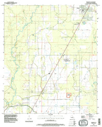
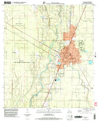 1998 Oakdale2003 Print · USGSOakdale and the surrounding Allen Parish wetlands are documented here in the late 1990s as the community balanced industrial growth with wildlife conservation. Researchers can trace family sites at Cryer Cem and Oak Hill Ch or follow the Old Railroad Grade through the woods.
End of results
Showing maps 1-10 of 10
Top cities of Allen Parish
- Oakdale historical maps
- Kinder historical maps
- Oberlin historical maps
- Elizabeth historical maps
- Reeves historical maps
Frequently asked questions
- What are the different types of historical maps available for Allen Parish?
- What is the oldest map of Allen Parish?
- Where can I purchase historical maps of Allen Parish for my home or office?
- Where can I download high-res historical maps of Allen Parish?
- Are there historical topographic maps available for Allen Parish?
- Is there historical aerial imagery available for Allen Parish?
- Where are historical maps of Allen Parish sourced from?