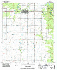
1994 Map of Elton
USGS Topo · Published 1996About this map
Elton serves as the central hub of this South Louisiana landscape, situated at the intersection of the Allen Parish Jefferson Davis Parish boundary. The area's mid-1990s character is defined by a dense network of rice fields and irrigation infrastructure, evidenced by the numerous wells and the Pumping Station located south of the main settlement. The industrial footprint of the region is clearly visible through the Oil And Gas Field near China and the multiple pipelines that traverse the terrain.
Find a feature on this map
18 named features on this map. Tap any name to fly to it.
Don’t see what you’re looking for? This feature index may not catch every label — zoom into the map to look around manually.
Map Details
Editions of this 1994 Elton Map
This is the sole edition of this map. No revisions or reprints were ever made.
Other maps of this area

1947 · Evangeline
USGS Topo · 1:31,680

1947 · Kinder
USGS Topo · 1:31,680

1947 · Fruge Lake
USGS Topo · 1:31,680

1947 · Oberlin
USGS Topo · 1:31,680

1947 · Pine Island
USGS Topo · 1:31,680

1947 · Elton
USGS Topo · 1:31,680

1947 · Hathaway
USGS Topo · 1:31,680

1947 · Basile
USGS Topo · 1:31,680

1949 · Bayou Blue
USGS Topo · 1:31,680

1949 · Basile
USGS Topo · 1:31,680