
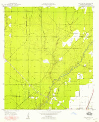
1935 Map of Oakdale
USGS Topo · Published 1935About this map
Oakdale serves as the central hub of this 1935 survey, appearing at a critical junction of industry and transport in Allen Parish. The town's grid is bisected by the Missouri Pacific Railroad and the Gulf Colorado and Santa Fe Railroad, reflecting its importance as a shipping point. The surrounding landscape is defined by the winding course of the Calcasieu River and a dense network of timber infrastructure. Numerous sections of Logging Railroad and segments of Old Logging Railroad Grade crisscross the terrain, marking the legacy of the local lumber industry. Beyond the industrial corridors, local life is anchored by landmarks such as the Oak Hill Ch to the north and the Oakdale Airport to the west. Waterways like Cherrywinche Creek and Curtis Creek drain the timberlands, illustrating the natural drainage patterns that dictated the placement of rail lines and early roads.
Find a feature on this map
17 named features on this map. Tap any name to fly to it.
Don’t see what you’re looking for? This feature index may not catch every label — zoom into the map to look around manually.
Map Details
Editions of this 1935 Oakdale Map
This is the sole edition of this map. No revisions or reprints were ever made.
Other maps of this area

1935 · Beaver
USGS Topo · 1:31,680

1935 · Pawnee
USGS Topo · 1:31,680

1942 · Oakdale
USGS Topo · 1:62,500

1947 · Foley
USGS Topo · 1:31,680

1947 · Steep Gully
USGS Topo · 1:31,680

1947 · Pine Chapel
USGS Topo · 1:31,680

1947 · Bond
USGS Topo · 1:31,680

1947 · Elizabeth
USGS Topo · 1:31,680

1948 · Elizabeth
USGS Topo · 1:24,000
1948 · Pine Chapel
USGS Topo · 1:24,000