
1947 Map of Bond
USGS Topo · Published 1947About this map
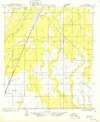
Bayou Nezpique and its branching tributaries define the drainage and settlement patterns along the border of Allen and Evangeline Parishes. This landscape is shaped by the legacy of the timber industry, marked by the extensive Old Logging Railroad Grade that winds through the northern sections. While the terrain is dominated by watercourses like West Fork and Caney Creek, human settlement is concentrated around small hubs and rural educational centers. Local genealogists can trace the early mid-century locations of the High Point Sch, John Reid Sch, and Johnson Cove Sch, which served the scattered residents of Bond and Hampton. The presence of State Highway No 22 and State Highway No 220 indicates the transitioning transportation network as roads began to follow the paths formerly dominated by logging rails.
Find a feature on this map
18 named features on this map. Tap any name to fly to it.
Don’t see what you’re looking for? This feature index may not catch every label — zoom into the map to look around manually.
Map Details
Editions of this 1947 Bond Map
This is the sole edition of this map. No revisions or reprints were ever made.
Other maps of this area

1935 · Beaver
USGS Topo · 1:31,680

1935 · Oakdale
USGS Topo · 1:31,680

1935 · Turkey Creek
USGS Topo · 1:62,500

1942 · Oakdale
USGS Topo · 1:62,500

1947 · Fruge Lake
USGS Topo · 1:31,680

1947 · Foley
USGS Topo · 1:31,680

1947 · Redland
USGS Topo · 1:31,680

1949 · Bayou Blue
USGS Topo · 1:31,680

1949 · Turkey Creek
USGS Topo · 1:62,500
1950 · Foley
USGS Topo · 1:31,680