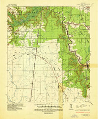
1949 Map of Turkey Creek
USGS Topo · Published 1965About this map
The confluence of Evangeline, Rapides, and Avoyelles parishes reveals a landscape transitioning from the bayou-laced lowlands to industrializing timber and oil lands. Just before the midpoint of the century, Messer Settlement and Nobrae exist alongside a dense network of family-named landmarks like Fontenot Cem, Dahany Cem, and Campbell Cem, providing vital clues for genealogical research in this part of Louisiana. The regional economy is anchored by the Ville Platte Oil Field and the Rock Island RR, while the emerging infrastructure includes the 6" Gas Pipe Line Tex-La Pipe Line Corp. Conservation efforts are visible at Chicot State Park, where the waters of Chicot Lake and Mountain Bayou Lake are clearly delineated. From the Lookout Tower near Turkey Creek to the Gravel Pit near Belle Chaney, the map captures the rural industry and community foundations of the late 1940s.
Find a feature on this map
62 named features on this map. Tap any name to fly to it.
Don’t see what you’re looking for? This feature index may not catch every label — zoom into the map to look around manually.
Map Details
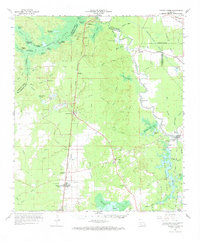
Editions of this 1949 Turkey Creek Map
This is the sole edition of this map. No revisions or reprints were ever made.
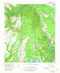
Historical Maps of Bunkie Through Time
3 maps found