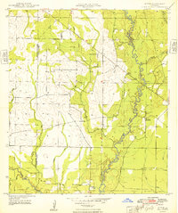
1948 Map of Mittie
USGS Topo · Published 1948About this map
Whisky Chitto Creek meanders through the piney woods of western Louisiana, defining the central drainage of this late 1940s landscape. The settlement of Mittie serves as a local hub near the creek, while further south, the Simmons Settlement and Simmons Cemetery highlight the area's genealogical roots. Evidence of the region's industrial past is visible in the Old Railroad Grade that cuts across the northern terrain, tracing the path of former timber or freight lines that once moved through the parishes.
Find a feature on this map
18 named features on this map. Tap any name to fly to it.
Don’t see what you’re looking for? This feature index may not catch every label — zoom into the map to look around manually.
Map Details
Editions of this 1948 Mittie Map
This is the sole edition of this map. No revisions or reprints were ever made.
Other maps of this area

1935 · Mittie
USGS Topo · 1:31,680

1947 · Oberlin
USGS Topo · 1:31,680

1947 · Pine Chapel
USGS Topo · 1:31,680

1947 · Le Blanc
USGS Topo · 1:31,680

1947 · Reeves
USGS Topo · 1:31,680

1947 · Elizabeth
USGS Topo · 1:31,680

1947 · Grant
USGS Topo · 1:31,680

1947 · Bundick
USGS Topo · 1:31,680

1947 · Sugartown
USGS Topo · 1:31,680

1948 · Grant
USGS Topo · 1:24,000