
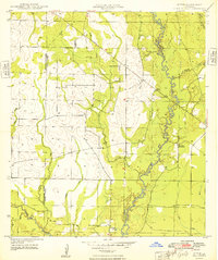
1948 Map of Grant
USGS Topo · Published 1948About this map
Fairview Grant PO serves as the primary node of settlement in this rural landscape spanning the border of Beauregard and Allen Parishes. Surveyed shortly after the war, the map reveals a community defined by its watercourses and rural institutions. The winding Whisky Chitto Creek and Sixmile Creek dominate the drainage pattern, while the presence of the Old Camp Ground Cem and Hamilton Cem suggest deep-rooted family ties to the land. This era captures the area before modern consolidation, with localized centers of worship and community like Palestine Ch, Palestine Mission Ch, and Arkadelphia Ch scattered across the timbered sections. The mapping of small tributaries such as Little Soapstone Creek and Caney Branch provides a fine-grained look at the drainage and terrain that once dictated the placement of early homes and small-scale agriculture in this part of Louisiana.
Find a feature on this map
20 named features on this map. Tap any name to fly to it.
Don’t see what you’re looking for? This feature index may not catch every label — zoom into the map to look around manually.
Map Details
Editions of this 1948 Grant Map
This is the sole edition of this map. No revisions or reprints were ever made.
Other maps of this area

1935 · Mittie
USGS Topo · 1:31,680

1947 · Steep Gully
USGS Topo · 1:31,680

1947 · Pine Chapel
USGS Topo · 1:31,680

1947 · Elizabeth
USGS Topo · 1:31,680

1947 · Grant
USGS Topo · 1:31,680

1947 · Bundick
USGS Topo · 1:31,680

1947 · Sugartown
USGS Topo · 1:31,680

1947 · Sugrue
USGS Topo · 1:31,680

1947 · Pitkin
USGS Topo · 1:31,680
1948 · Mittie
USGS Topo · 1:24,000