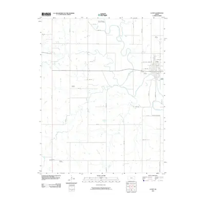
2009 Map of Le Roy
USGS Topo · Published 2009About this map
The Neosho River meanders through this portion of Coffey County, defining the agricultural landscape near the town of Leroy. Several family and community burial sites are preserved across the quadrangle, including the Lorenz Schlichter Memorial Cemetery to the north and Crandell Cemetery further west. In the south, Saint Michaels Church and the Shaffer Cemetery sit near the confluence of Turkey Creek and Bloody Run. The town of Leroy itself shows a traditional grid of streets like Grand Ave and Main St, supported by the nearby Leroy Airport. The drainage network is particularly dense here, with Duck Creek, Rock Creek, and Cherry Creek all feeding into the primary river valley, illustrating the complex hydrology of this eastern Kansas prairie region.
Find a feature on this map
54 named features on this map. Tap any name to fly to it.
Don’t see what you’re looking for? This feature index may not catch every label — zoom into the map to look around manually.
Map Details
Editions of this 2009 Le Roy Map
This is the sole edition of this map. No revisions or reprints were ever made.
Other maps of this area

1885 · Burlington
USGS Topo · 1:125,000

1886 · Fredonia
USGS Topo · 1:125,000

1894 · Fredonia
USGS Topo · 1:125,000

1894 · Burlington
USGS Topo · 1:125,000

1947 · Lawrence
USGS Topo · 1:250,000

1947 · Joplin
USGS Topo · 1:250,000

1949 · Joplin
USGS Topo · 1:250,000

1950 · Lawrence
USGS Topo · 1:250,000

1954 · Joplin
USGS Topo · 1:250,000

1956 · Lawrence
USGS Topo · 1:250,000