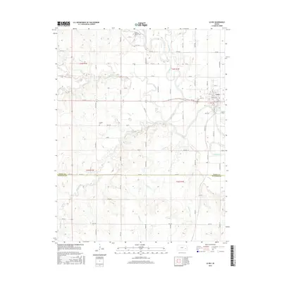
2015 Map of Le Roy
USGS Topo · Published 2015About this map
LeRoy sits at a prominent bend in the Neosho River, where the landscape is defined by the complex hydrology of eastern Kansas. This area, marking the boundary between Coffey and Woodson Counties, is characterized by a dense network of watercourses including Big Creek, South Big Creek, and Turkey Creek. The map shows a transition from the structured residential grid of LeRoy, featuring streets like Nebraska Ave and Scott St, to the expansive rural sections defined by the Public Land Survey System. Genealogists and local historians can locate several burial grounds, such as the Le Roy Cemetery east of town, the centrally located Crandell Cemetery, and the Lorenz Schlichter Memorial Cemetery situated near the northern edge of the survey area.
Find a feature on this map
77 named features on this map. Tap any name to fly to it.
Don’t see what you’re looking for? This feature index may not catch every label — zoom into the map to look around manually.
Map Details
Editions of this 2015 Le Roy Map
This is the sole edition of this map. No revisions or reprints were ever made.
Other maps of this area

1885 · Burlington
USGS Topo · 1:125,000

1886 · Fredonia
USGS Topo · 1:125,000

1894 · Fredonia
USGS Topo · 1:125,000

1894 · Burlington
USGS Topo · 1:125,000

1947 · Lawrence
USGS Topo · 1:250,000

1947 · Joplin
USGS Topo · 1:250,000

1949 · Joplin
USGS Topo · 1:250,000

1950 · Lawrence
USGS Topo · 1:250,000

1954 · Joplin
USGS Topo · 1:250,000

1956 · Lawrence
USGS Topo · 1:250,000