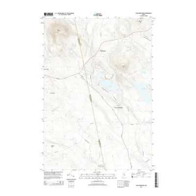
2014 Map of Lead Mountain
USGS Topo · Published 2014About this map
Beddington and Lower Beddington serve as the primary focal points of this Down East landscape, situated where the Airline Rd crosses the complex waterways of Washington County. The map reveals a region defined by its glacial hydrology, with Beddington Lake and Spruce Mountain Lake dominating the central terrain. The Narraguagus River and its various tributaries, including the W Br Narraguagus River and Pork Brook, carve through a series of prominent elevations such as Lead Mountain and Pleasant Mtn. The transport network of the mid-2010s is clearly delineated, showing established routes like Me-193 and numerous local timber and access roads like Blueberry Field Rd and St Regis 4400. This survey offers a precise record of the shoreline and topographical details of the various ponds, from Chalk Pond to Upper Lead Mountain Pond, as they appeared before recent shifts in land use or environmental change.
Find a feature on this map
52 named features on this map. Tap any name to fly to it.
Don’t see what you’re looking for? This feature index may not catch every label — zoom into the map to look around manually.
Map Details
Editions of this 2014 Lead Mountain Map
This is the sole edition of this map. No revisions or reprints were ever made.
Other maps of this area

1902 · Cherryfield
USGS Topo · 1:62,500

1904 · Cherryfield
USGS Topo · 1:62,500

1929 · Lead Mountain
USGS Topo · 1:48,000

1930 · Tunk Lake
USGS Topo · 1:48,000

1932 · Tunk Lake
USGS Topo · 1:62,500

1932 · Lead Mountain
USGS Topo · 1:62,500

1941 · Tug Mountain
USGS Topo · 1:62,500

1942 · Cherryfield
USGS Topo · 1:62,500

1942 · Tunk Lake
USGS Topo · 1:62,500

1943 · Tug Mountain
USGS Topo · 1:62,500