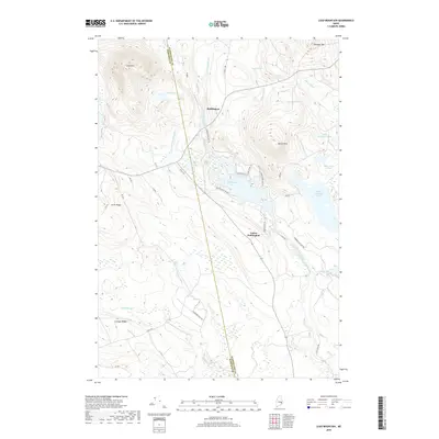
2018 Map of Lead Mountain
USGS Topo · Published 2018About this map
Beddington and Lower Beddington serve as the primary points of settlement in this northern Maine interior, situated along the Narraguagus River system. The landscape is defined by its dramatic relief and abundant water bodies, including Beddington Lake and the high summit of Lead Mtn. Named ridges such as Smith Ridge and Schoppe Ridge break the terrain, while the local industry is hinted at by the presence of Blueberry Field Rd. The network of forestry and access roads like ST Regis 4400 and 3000 RD weave through the hills, providing a window into the land management and resource extraction patterns of the era. Smaller ponds like Bear Pond and Gray Pond are scattered throughout the dense topography, connected by various brooks that feed into the larger river basins.
Find a feature on this map
45 named features on this map. Tap any name to fly to it.
Don’t see what you’re looking for? This feature index may not catch every label — zoom into the map to look around manually.
Map Details
Editions of this 2018 Lead Mountain Map
This is the sole edition of this map. No revisions or reprints were ever made.
Other maps of this area

1902 · Cherryfield
USGS Topo · 1:62,500

1904 · Cherryfield
USGS Topo · 1:62,500

1929 · Lead Mountain
USGS Topo · 1:48,000

1930 · Tunk Lake
USGS Topo · 1:48,000

1932 · Tunk Lake
USGS Topo · 1:62,500

1932 · Lead Mountain
USGS Topo · 1:62,500

1941 · Tug Mountain
USGS Topo · 1:62,500

1942 · Cherryfield
USGS Topo · 1:62,500

1942 · Tunk Lake
USGS Topo · 1:62,500

1943 · Tug Mountain
USGS Topo · 1:62,500