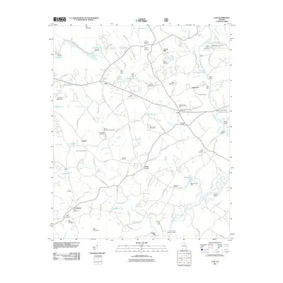
2011 Map of Leaf
USGS Topo · Published 2011About this map
Stovall Mill and Rogers Mill anchor a landscape defined by the winding course of the Chattahoochee River and its numerous tributaries like Blue Creek and Mossy Creek. This Georgia terrain is marked by a high density of community landmarks, including the Union Grove Campground and Mossy Creek Campground, which suggest long-standing rural gathering points. Small settlements such as Kinseytown, Leaf, and Centerside are interconnected by a network of local roads like Barrett Mill Rd and Hulsey Mill Rd. The presence of several family-named burial grounds, such as the Old Blue Creek Cemetery and Macedonia Cemetery, provides a clear spatial record for genealogists tracing regional lineages. Significant water management is evident through numerous private and public dams, including the Warwick Lake Dam and Webster Lake Dam, while local aviation is represented by Mountain Airpark and the White County Landing Field.
Find a feature on this map
119 named features on this map. Tap any name to fly to it.
Don’t see what you’re looking for? This feature index may not catch every label — zoom into the map to look around manually.
Map Details
Editions of this 2011 Leaf Map
This is the sole edition of this map. No revisions or reprints were ever made.
Other maps of this area

1886 · Dahlonega
USGS Topo · 1:125,000

1891 · Gainesville
USGS Topo · 1:125,000

1892 · Dahlonega
USGS Topo · 1:125,000

1896 · Dahlonega
USGS Topo · 1:125,000

1903 · Dahlonega
USGS Topo · 1:125,000

1935 · Cowrock
USGS Topo · 1:24,000

1938 · Cowrock
USGS Topo · 1:24,000
1950 · Cowrock
USGS Topo · 1:24,000

1951 · Cleveland
USGS Topo · 1:24,000
1952 · Cowrock
USGS Topo · 1:24,000