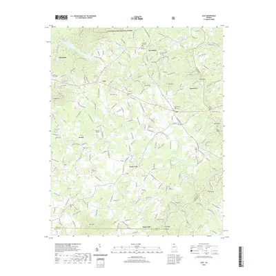
2020 Map of Leaf
USGS Topo · Published 2020About this map
The Chattahoochee National Forest marks the northern reaches of this landscape, where the Chattahoochee River begins to wind through the Piedmont foothills. The area is defined by a dense network of small rural communities and family landmarks, including the historic Stovall Mill and the campus of Truett McConnell University in Cleveland. The terrain is punctuated by significant heights such as Leadpole Mtn and Skitt Mtn, which frame the agricultural and residential pockets of Leaf, Leo, and Mossy Creek.
Find a feature on this map
109 named features on this map. Tap any name to fly to it.
Don’t see what you’re looking for? This feature index may not catch every label — zoom into the map to look around manually.
Map Details
Editions of this 2020 Leaf Map
This is the sole edition of this map. No revisions or reprints were ever made.
Other maps of this area

1886 · Dahlonega
USGS Topo · 1:125,000

1891 · Gainesville
USGS Topo · 1:125,000

1892 · Dahlonega
USGS Topo · 1:125,000

1896 · Dahlonega
USGS Topo · 1:125,000

1903 · Dahlonega
USGS Topo · 1:125,000

1935 · Cowrock
USGS Topo · 1:24,000

1938 · Cowrock
USGS Topo · 1:24,000
1950 · Cowrock
USGS Topo · 1:24,000

1951 · Cleveland
USGS Topo · 1:24,000
1952 · Cowrock
USGS Topo · 1:24,000