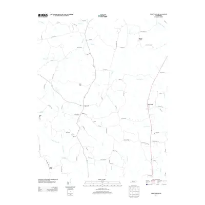
2013 Map of Leapwood
USGS Topo · Published 2013About this map
Leapwood and the surrounding rural communities of Mount Zion and Mud Creek anchor this survey of McNairy County, Tennessee. The landscape is heavily defined by its water management, featuring significant engineered waterways such as the Snake Creek Canal and the White Oak Creek Canal, which run alongside their natural counterparts like Snake Creek and White Oak Creek. These canals suggest a history of reclaiming bottomlands for agriculture, particularly in areas like Enville Bottom. Local history researchers will find many family-named landmarks and infrastructure, including Hardin Graveyard Road and Combs Cemetery Road, indicating long-standing familial ties to the land. The topography rises toward the west at Clover Hill and Bald Knob, while the road network connects smaller settlements via routes like Beauty Hill Road and Winding Ridge.
Find a feature on this map
81 named features on this map. Tap any name to fly to it.
Don’t see what you’re looking for? This feature index may not catch every label — zoom into the map to look around manually.
Map Details
Editions of this 2013 Leapwood Map
This is the sole edition of this map. No revisions or reprints were ever made.
Other maps of this area

1936 · Leapwood
USGS Topo · 1:24,000

1936 · Sardis
USGS Topo · 1:24,000

1936 · Milledgeville
USGS Topo · 1:24,000

1936 · Enville
USGS Topo · 1:24,000

1936 · Pittsburg Landing
USGS Topo · 1:24,000

1936 · Purdy
USGS Topo · 1:24,000

1936 · Stantonville
USGS Topo · 1:24,000

1936 · Mt. Peter
USGS Topo · 1:24,000

1949 · Pittsburg Landing
USGS Topo · 1:24,000

1949 · Leapwood
USGS Topo · 1:24,000