
1936 Map of Leatherwood
USGS Topo · Published 1936About this map
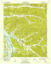
Buffalo River and Green River dictate the settlement patterns of this 1930s landscape in Wayne and Perry Counties. The rural economy relies heavily on these waterways and their numerous tributaries, such as Beech Creek and Canoe Branch, which are crossed by a network of named crossings like Slink Shoals Ford, Lincoln Ford, and Bartley Bridge. This era of the Tennessee Valley Authority project is captured during a transition toward modern infrastructure, showing the presence of State Highway No 13 alongside traditional landmarks.
Find a feature on this map
52 named features on this map. Tap any name to fly to it.
Don’t see what you’re looking for? This feature index may not catch every label — zoom into the map to look around manually.
Map Details
Editions of this 1936 Leatherwood Map
This is the sole edition of this map. No revisions or reprints were ever made.
Other maps of this area

1905 · Waynesboro
USGS Topo · 1:125,000

1936 · Graves Spring
USGS Topo · 1:24,000

1936 · Eagle Creek
USGS Topo · 1:24,000

1936 · Linden
USGS Topo · 1:24,000

1936 · Negro Hollow
USGS Topo · 1:24,000

1936 · Clifton
USGS Topo · 1:24,000

1936 · Waynesboro
USGS Topo · 1:24,000

1936 · Topsy
USGS Topo · 1:24,000

1936 · Pope
USGS Topo · 1:24,000
1949 · Pope
USGS Topo · 1:24,000