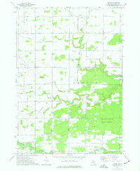
1973 Map of Leaton
USGS Topo · Published 1977About this map
The Indian Reservation Boundary cuts through central Isabella County, defining a landscape shaped by petroleum extraction and heavy timber. This early 1970s topography reveals the extensive reach of the Mount Pleasant Oil Field, Rosebush Oil Field, and Vernon Oil Field, with numerous wells and a Pipeline networked across the sections. The settlement of Leaton sits at the junction of Leaton Road and the Chesapeake and Ohio railroad, while Delwin occupies a position further north along the tracks. Natural drainage is dominated by the Chippewa River and the branching Salt River system, which feed into the dense woodlands of the Chippewa River State Forest. Local history is anchored by the Bissing Cem and River Lawn Cem, serving the scattered rural townships of Denver and Isabella.
Find a feature on this map
46 named features on this map. Tap any name to fly to it.
Don’t see what you’re looking for? This feature index may not catch every label — zoom into the map to look around manually.
Map Details
Editions of this 1973 Leaton Map
This is the sole edition of this map. No revisions or reprints were ever made.
Other maps of this area

1916 · Mount Pleasant
USGS Topo · 1:62,500

1919 · Mount Pleasant
USGS Topo · 1:62,500

1930 · Shepherd
USGS Topo · 1:48,000

1936 · Shepherd
USGS Topo · 1:62,500

1943 · Mount Pleasant
USGS Topo · 1:62,500

1954 · Midland
USGS Topo · 1:250,000

1958 · Midland
USGS Topo · 1:250,000

1959 · Midland
USGS Topo · 1:250,000

1959 · Clare
USGS Topo · 1:62,500

1966 · Midland
USGS Topo · 1:250,000