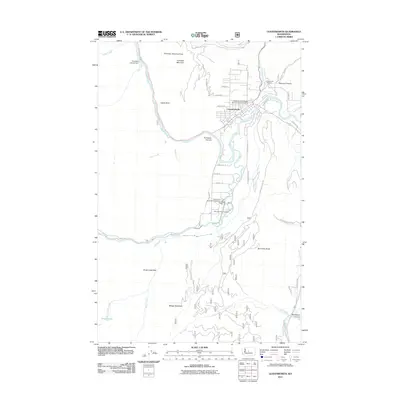
2011 Map of Leavenworth
USGS Topo · Published 2011About this map
The town of Leavenworth is the focal point of this 2011 survey, situated where the Wenatchee River emerges from the steep walls of Tumwater Canyon. The landscape is defined by the convergence of several major water systems, including Icicle Creek, Chumstick Creek, and Peshastin Creek, which have historically shaped the local infrastructure and settlement patterns. Notable civic and federal landmarks include the Wenatchee River Ranger District-Leavenworth Office and the Leavenworth National Fish Hatchery located south of the main town site.
Find a feature on this map
49 named features on this map. Tap any name to fly to it.
Don’t see what you’re looking for? This feature index may not catch every label — zoom into the map to look around manually.
Map Details
Editions of this 2011 Leavenworth Map
This is the sole edition of this map. No revisions or reprints were ever made.
Other maps of this area

1897 · Mount Stuart
USGS Topo · 1:125,000

1901 · Chiwaukum
USGS Topo · 1:125,000

1902 · Mount Stuart
USGS Topo · 1:125,000

1904 · Chiwaukum
USGS Topo · 1:125,000

1957 · Wenatchee
USGS Topo · 1:250,000

1961 · Liberty
USGS Topo · 1:62,500

1961 · Mount Stuart
USGS Topo · 1:62,500

1964 · Leavenworth
USGS Topo · 1:62,500

1965 · Chiwaukum Mts
USGS Topo · 1:62,500

1975 · Wenatchee
USGS Topo · 1:100,000