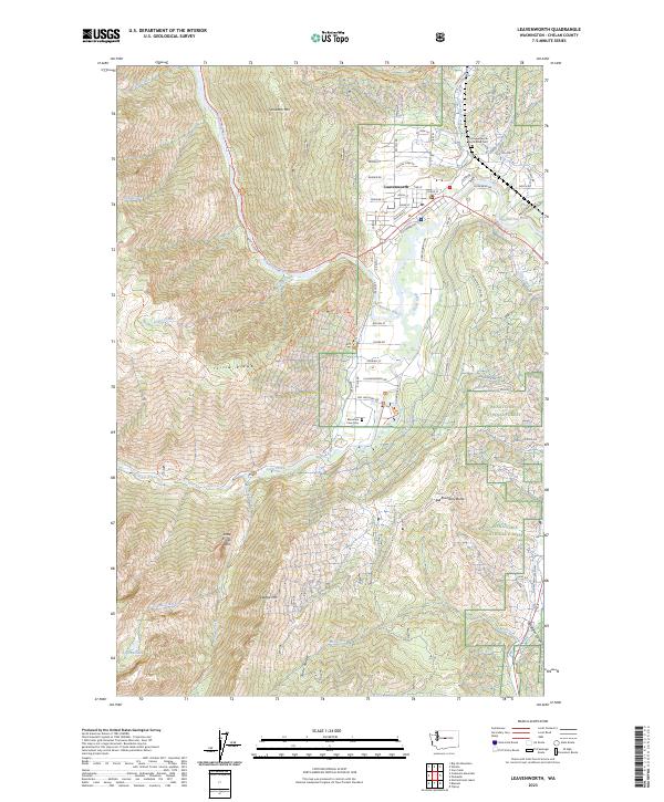
2023 Map of Leavenworth
USGS Topo · Published 2023About this map
Leavenworth serves as the focal point of this 2023 survey, situated at the convergence of the Wenatchee River and Icicle Creek. The town's grid is characterized by street names like Front St, Alpensee Strasse, and W Commercial St, reflecting its developed character amid a high-relief landscape. The surrounding area is dominated by the Wenatchee National Forest and the protected Alpine Lakes Wilderness, where prominent landmarks such as Icicle Ridge, Wedge Mtn, and the sheer Snow Creek Wall define the horizon. Local history and land use are visible through the Leavenworth National Fish Hatchery and genealogical markers like Old Leavenworth North Road Cem and Mountain View Cem. From the winding Icicle Canal to the heights of the Stuart Range, the map illustrates a landscape where municipal growth and federal conservation efforts meet.
Find a feature on this map
77 named features on this map. Tap any name to fly to it.
Don’t see what you’re looking for? This feature index may not catch every label — zoom into the map to look around manually.
Map Details
Editions of this 2023 Leavenworth Map
This is the sole edition of this map. No revisions or reprints were ever made.
Other maps of this area

1897 · Mount Stuart
USGS Topo · 1:125,000

1901 · Chiwaukum
USGS Topo · 1:125,000

1902 · Mount Stuart
USGS Topo · 1:125,000

1904 · Chiwaukum
USGS Topo · 1:125,000

1957 · Wenatchee
USGS Topo · 1:250,000

1961 · Liberty
USGS Topo · 1:62,500

1961 · Mount Stuart
USGS Topo · 1:62,500

1964 · Leavenworth
USGS Topo · 1:62,500

1965 · Chiwaukum Mts
USGS Topo · 1:62,500

1975 · Wenatchee
USGS Topo · 1:100,000