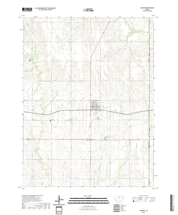
2022 Map of Lebanon
USGS Topo · Published 2022About this map
Lebanon serves as the central hub for this North Central Kansas landscape, where the grid of agricultural section roads meets the course of multiple prairie waterways. The town's layout is clearly defined by its relationship to the rail corridor, with streets like N Railway Ave and S Railway Ave flanking the tracks. This modern survey reflects a deeply rooted rural community, preserving the locations of early burial grounds such as Oak Hill Cem, Price Cem, and Sweet Home Cem which are scattered throughout the surrounding townships. The drainage pattern is complex for a plains region, shaped by the diverging paths of Middle Oak Cr, Spring Cr, and White Rock Cr. These streams, along with others like Frog Cr and Porcupine Cr, dictate the movement of the local terrain and provide essential landmarks for genealogists tracing family farmsteads across the Smith and Jewell County line.
Find a feature on this map
49 named features on this map. Tap any name to fly to it.
Don’t see what you’re looking for? This feature index may not catch every label — zoom into the map to look around manually.
Map Details
Editions of this 2022 Lebanon Map
This is the sole edition of this map. No revisions or reprints were ever made.
Other maps of this area

1893 · Smith Center
USGS Topo · 1:125,000

1894 · Mankato
USGS Topo · 1:125,000

1955 · Beloit
USGS Topo · 1:250,000

1959 · Beloit
USGS Topo · 1:250,000
1968 · Burr Oak NW
USGS Topo · 1:24,000
1969 · Cawker City NW
USGS Topo · 1:24,000
1969 · Esbon
USGS Topo · 1:24,000
1973 · Portis NE
USGS Topo · 1:24,000
1973 · Cora
USGS Topo · 1:24,000
1973 · Mc Cracken Branch
USGS Topo · 1:24,000