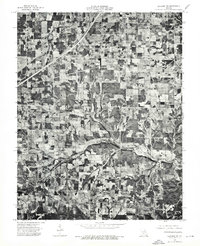
1975 Map of Lebanon SW
USGS Topo · Published 1976About this map
Morgan anchors the southern portion of this 1970s orthophoto, where the landscape transitions from the open agricultural plots of the north to more densely timbered terrain. This photographic survey, prepared under State Geologist Wallace B. Howe, provides a visual record of the land use patterns in Laclede County during the mid-seventies. The meandering course of Brush Creek cuts across the center and upper reaches of the map, carving distinct valleys through the Missouri countryside. Unlike traditional line-drawn maps, this aerial imagery reveals the exact footprint of farmsteads, the density of woodlots, and the precise alignment of rural roads as they existed just before the turn of the final quarter of the century.
Find a feature on this map
2 named features on this map. Tap any name to fly to it.
Don’t see what you’re looking for? This feature index may not catch every label — zoom into the map to look around manually.
Map Details
Editions of this 1975 Lebanon SW Map
This is the sole edition of this map. No revisions or reprints were ever made.
Other maps of this area

1939 · Long Lane
USGS Topo · 1:62,500

1941 · Lebanon
USGS Topo · 1:62,500

1942 · Long Lane
USGS Topo · 1:62,500

1943 · Lebanon
USGS Topo · 1:62,500

1946 · Niangua
USGS Topo · 1:62,500

1948 · Niangua
USGS Topo · 1:62,500

1954 · Springfield
USGS Topo · 1:250,000

1956 · Rader
USGS Topo · 1:24,000
1956 · Grovespring
USGS Topo · 1:24,000

1958 · Springfield
USGS Topo · 1:250,000