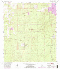
1954 Map of Lecanto
USGS Topo · Published 1988About this map
Withlacoochee State Forest dominates the central portion of this Citrus County landscape, which transitions between the settlement of Lecanto and the surrounding karst-pitted terrain. Originally surveyed in the mid-1950s, the topography is defined by numerous solution depressions and water bodies typical of the Florida aquifer, including Bull Sink, Fivemile Pond, and Hog Pond. Evidence of the region's extractive economy appears at the Holder Mine and a local Quarry, which are situated amidst the wooded sections of the state forest. A 1988 revision, indicated by purple overlays, shows the expansion of residential street grids near Lecanto, reflecting the growth of this interior community. Further south, the map records the location of Landrum, providing a detailed look at the rural road networks and isolated structures like a Windmill that once dotted the landscape.
Find a feature on this map
10 named features on this map. Tap any name to fly to it.
Don’t see what you’re looking for? This feature index may not catch every label — zoom into the map to look around manually.
Map Details
Editions of this 1954 Lecanto Map
5 editions found
Other maps of this area

1895 · Tsala Apopka
USGS Topo · 1:62,500

1954 · Lecanto
USGS Topo · 1:24,000

1954 · Homosassa
USGS Topo · 1:24,000

1954 · Holder
USGS Topo · 1:24,000

1954 · Crystal River
USGS Topo · 1:24,000

1954 · Brooksville NW
USGS Topo · 1:24,000

1954 · Nobleton
USGS Topo · 1:24,000

1954 · Tsala Apopka NE
USGS Topo · 1:24,000

1954 · Chassahowitzka
USGS Topo · 1:24,000

1954 · Inverness
USGS Topo · 1:24,000