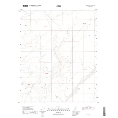
2018 Map of Lee Mountain
USGS Topo · Published 2018About this map
Lee Mtn and the prominent Marcou Mesa anchor this landscape in Navajo County, where a complex network of ephemeral drainages defines the high desert floor. The map highlights the significant channel of Leroux Wash cutting through the southeastern corner, while smaller tributaries like Billy Wash, Joseph City Wash, and Jacobs Wash snake across the township and range boundaries. This area represents a transition between highland mesas and the broader basin drainages, characterized by subtle elevation changes and the strategic placement of water management features such as Badland Tank and the Lee Mountain Tanks. These tanks are critical landmarks for understanding land use and cattle ranching history in this arid portion of Arizona, showing how resources were managed across t19n r20e and surrounding survey sections.
Find a feature on this map
13 named features on this map. Tap any name to fly to it.
Don’t see what you’re looking for? This feature index may not catch every label — zoom into the map to look around manually.
Map Details
Editions of this 2018 Lee Mountain Map
This is the sole edition of this map. No revisions or reprints were ever made.
Other maps of this area

1883 · Tusayan
USGS Topo · 1:250,000

1886 · Tusayan
USGS Topo · 1:250,000

1886 · Holbrook
USGS Topo · 1:250,000

1893 · Holbrook
USGS Topo · 1:250,000

1947 · Flagstaff
USGS Topo · 1:250,000

1954 · Flagstaff
USGS Topo · 1:250,000

1954 · Holbrook
USGS Topo · 1:250,000

1955 · St. Joseph 1 NE
USGS Topo · 1:24,000

1955 · St. Joseph 1 NW
USGS Topo · 1:24,000
1955 · St. Joseph 2 NE
USGS Topo · 1:24,000