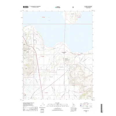
2018 Map of Lee Vining
USGS Topo · Published 2018About this map
Mono Lake dominates the northern landscape of this Mono County survey, surrounding the distinct landform of Paoha Island. To the south, the terrain transitions into a dramatic volcanic field characterized by the Mono Craters and Crater Mountain, with Panum Crater and the Panum Crater Pit situated just south of Navy Beach. The settlement of Lee Vining sits at the base of the Sierra Nevada range, where Tioga Pass Rd begins its ascent into Lee Vining Canyon. The map reveals a complex network of forest access and utility routes within the Inyo National Forest, including the Farrington Siphon and various connectors through Pumice Valley. These features illustrate the intersection of unique geological formations and the infrastructure required to manage the high-desert environment and local water resources.
Find a feature on this map
49 named features on this map. Tap any name to fly to it.
Don’t see what you’re looking for? This feature index may not catch every label — zoom into the map to look around manually.
Map Details
Editions of this 2018 Lee Vining Map
This is the sole edition of this map. No revisions or reprints were ever made.
Other maps of this area

1901 · Mt. Lyell
USGS Topo · 1:125,000

1909 · Hawthorne
USGS Topo · 1:250,000

1909 · Bridgeport
USGS Topo · 1:125,000

1911 · Bridgeport
USGS Topo · 1:125,000

1911 · Hawthorne
USGS Topo · 1:250,000

1914 · Mt. Morrison
USGS Topo · 1:125,000

1915 · Hawthorne
USGS Topo · 1:250,000

1920 · Bridgeport
USGS Topo · 1:125,000

1947 · Mariposa
USGS Topo · 1:250,000

1948 · Walker Lake
USGS Topo · 1:250,000