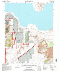
1994 Map of Lee Vining
USGS Topo · Published 1997About this map
Mono Lake dominates the northern horizon of this landscape, where the high desert meets the eastern escarpment. The town of Lee Vining sits at the mouth of Lee Vining Creek canyon, serving as a gateway between the lake's unique alkaline waters and the rising peaks. The map details the complex water infrastructure of the era, including the Los Angeles Aqueduct and various stream diversions like Rush Creek and Walker Creek, which have historically shaped the region's ecological and political narrative.
Find a feature on this map
23 named features on this map. Tap any name to fly to it.
Don’t see what you’re looking for? This feature index may not catch every label — zoom into the map to look around manually.
Map Details
Editions of this 1994 Lee Vining Map
This is the sole edition of this map. No revisions or reprints were ever made.
Other maps of this area

1901 · Mt. Lyell
USGS Topo · 1:125,000

1909 · Hawthorne
USGS Topo · 1:250,000

1909 · Bridgeport
USGS Topo · 1:125,000

1911 · Bridgeport
USGS Topo · 1:125,000

1911 · Hawthorne
USGS Topo · 1:250,000

1914 · Mt. Morrison
USGS Topo · 1:125,000

1915 · Hawthorne
USGS Topo · 1:250,000

1920 · Bridgeport
USGS Topo · 1:125,000

1947 · Mariposa
USGS Topo · 1:250,000

1948 · Walker Lake
USGS Topo · 1:250,000