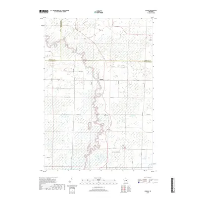
2018 Map of Leeman
USGS Topo · Published 2018About this map
The Wolf River winds in tight oxbows through the lowlands of Central Wisconsin, meeting the Shioc River south of the unincorporated settlement of Leeman. This 2018 survey reveals a landscape shaped by three counties—Shawano, Waupaca, and Outagamie—intersecting near a vast network of wetlands and river flats. The human footprint is defined by a rigorous grid of rural roads and a series of community-centered landmarks that serve the surrounding agricultural and marshy terrain. Genealogists and local historians will find several burial sites preserved on the landscape, including Saint Lawrence Cem in the northeast and Oak Hill Cem situated along Greeley Rd. Aviation history is noted by the presence of the Wolf River Landing Strip, positioned near the southern reaches of the river’s path, while family-named routes like Ashley Rd and Eskman Rd provide connections between isolated farmsteads and the water.
Find a feature on this map
37 named features on this map. Tap any name to fly to it.
Don’t see what you’re looking for? This feature index may not catch every label — zoom into the map to look around manually.
Map Details
Editions of this 2018 Leeman Map
This is the sole edition of this map. No revisions or reprints were ever made.
Other maps of this area

1955 · Embarrass
USGS Topo · 1:48,000

1955 · Appleton
USGS Topo · 1:62,500

1955 · Seymour
USGS Topo · 1:62,500

1955 · Green Bay
USGS Topo · 1:250,000

1956 · New London
USGS Topo · 1:48,000

1969 · New London
USGS Topo · 1:24,000

1969 · Leeman
USGS Topo · 1:24,000

1969 · Embarrass
USGS Topo · 1:24,000

1969 · Lunds
USGS Topo · 1:24,000

1969 · Bear Creek
USGS Topo · 1:24,000