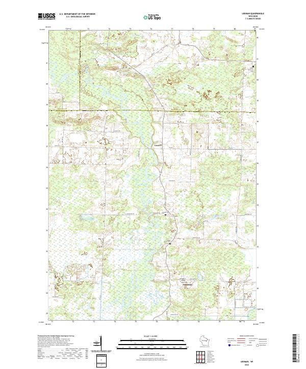
2022 Map of Leeman
USGS Topo · Published 2022About this map
The Wolf River winds dramatically through this landscape, marking a central topographical feature where the borders of Waupaca, Shawano, and Outagamie counties converge. The small settlement of Leeman sits along the river's path, serving as a focal point for the surrounding rural area. The terrain is defined by the complex hydrology of the river basin and the southern flow of the Shioc River. Local history and genealogy are anchored by several established burial sites, including Saint Lawrence Cem in the northeast, Oak Hill Cem, and South Maine Cem. This 2022 survey captures a rural Wisconsin landscape characterized by a grid of named local roads like Greeley Rd and Navarino Rd, alongside specialized features such as the Wolf River Landing Strip near the river's edge.
Find a feature on this map
37 named features on this map. Tap any name to fly to it.
Don’t see what you’re looking for? This feature index may not catch every label — zoom into the map to look around manually.
Map Details
Editions of this 2022 Leeman Map
This is the sole edition of this map. No revisions or reprints were ever made.
Other maps of this area

1955 · Embarrass
USGS Topo · 1:48,000

1955 · Appleton
USGS Topo · 1:62,500

1955 · Seymour
USGS Topo · 1:62,500

1955 · Green Bay
USGS Topo · 1:250,000

1956 · New London
USGS Topo · 1:48,000

1969 · New London
USGS Topo · 1:24,000

1969 · Leeman
USGS Topo · 1:24,000

1969 · Embarrass
USGS Topo · 1:24,000

1969 · Lunds
USGS Topo · 1:24,000

1969 · Bear Creek
USGS Topo · 1:24,000