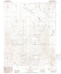
1987 Map of Lees Camp
USGS Topo · Published 1987About this map
Lees Camp stands as a focal point in this high-desert landscape on the edge of the Amargosa Desert and the Funeral Mountains. The area is defined by the Death Valley National Monument and the historic Von Schmidt Line (1873) marking the Nevada California Boundary. The map records an extensive history of mineral exploration, dotted with numerous prospects and a Gravel Pit. Notable for researchers of regional history is the location of Schwaub (Site) in the southern portion, near the rugged descent into Echo Canyon. The presence of the Old Rd Grade and multiple boundary monuments, including NPS Bdy Mon 98 and Usmm 138, illustrates the legacy of surveying and infrastructure in this arid corridor where Nye and Inyo counties meet.
Find a feature on this map
21 named features on this map. Tap any name to fly to it.
Don’t see what you’re looking for? This feature index may not catch every label — zoom into the map to look around manually.
Map Details
Editions of this 1987 Lees Camp Map
This is the sole edition of this map. No revisions or reprints were ever made.
Other maps of this area

1908 · Furnace Creek
USGS Topo · 1:250,000

1910 · Furnace Creek
USGS Topo · 1:250,000

1942 · Bullfrog
USGS Topo · 1:125,000

1948 · Death Valley
USGS Topo · 1:250,000

1952 · Chloride Cliff
USGS Topo · 1:50,000

1952 · Furnace Creek
USGS Topo · 1:62,500

1952 · Ryan
USGS Topo · 1:62,500

1952 · Big Dune
USGS Topo · 1:62,500

1954 · Death Valley
USGS Topo · 1:250,000

1956 · Death Valley
USGS Topo · 1:250,000