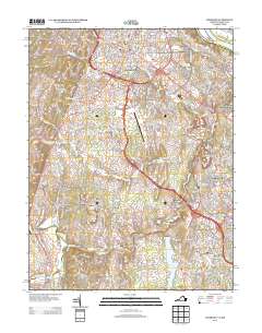
2013 Map of Leesburg
USGS Topo · Published 2013About this map
Goose Creek and its many tributaries, including Sycolin Creek and Tuscarora Creek, define the drainage of this Northern Virginia landscape as it appeared in the early 21st century. The map highlights the transition from the established outskirts of the county seat to suburban developments like Ashburn Farm and Belmont Greene. Significant local landmarks are documented, including the Leesburg Executive Airport and the sprawling Leesburg Corner Premium Outlets, alongside small historical communities such as Gleedsville, Little Washington, and Oatlands.
Find a feature on this map
57 named features on this map. Tap any name to fly to it.
Don’t see what you’re looking for? This feature index may not catch every label — zoom into the map to look around manually.
Map Details
Editions of this 2013 Leesburg Map
This is the sole edition of this map. No revisions or reprints were ever made.
Other maps of this area

1884 · Harpers Ferry
USGS Topo · 1:125,000

1890 · Mt. Vernon
USGS Topo · 1:125,000

1891 · Harpers Ferry
USGS Topo · 1:125,000

1891 · Mt. Vernon
USGS Topo · 1:125,000

1893 · Frederick
USGS Topo · 1:125,000

1893 · Harpers Ferry
USGS Topo · 1:125,000

1894 · Warrenton
USGS Topo · 1:125,000

1894 · Frederick
USGS Topo · 1:125,000

1894 · Mt. Vernon
USGS Topo · 1:125,000

1897 · Mt. Vernon
USGS Topo · 1:125,000