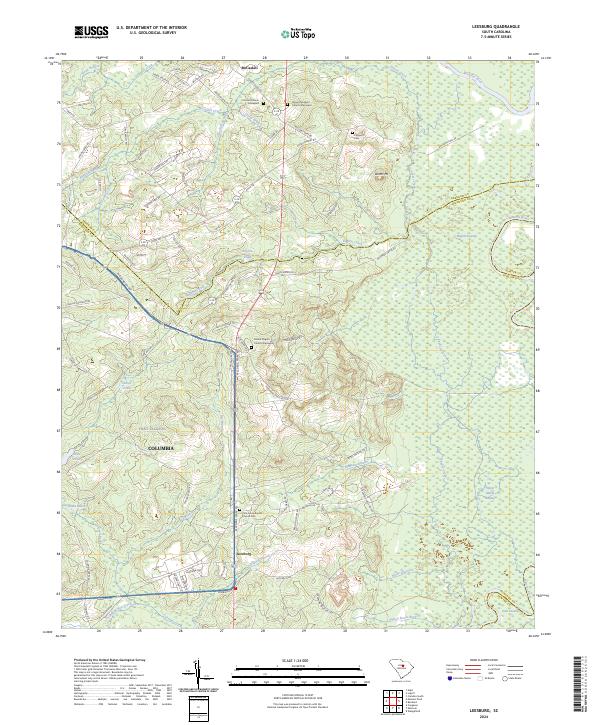
2024 Map of Leesburg
USGS Topo · Published 2024About this map
The expansive training grounds of Fort Jackson dominate the southwestern portion of this map, reflecting the long-standing military presence near Columbia. This landscape is defined by its complex hydrology, where numerous tributaries like Bee Branch and Leesburg Branch feed into Colonels Creek, eventually moving toward the Wateree River at the eastern boundary. The settlement pattern is largely rural, centered on the community of Leesburg and the northern hamlet of McCaskill. Genealogists will find significant value in the documentation of several historic burial sites, including the Mount Pilgrim Church Graveyard and Pine Grove Baptist Church Cem, which serve as landmarks of the area's religious heritage. The terrain transitions from the elevations of Dunns Mt down to the low-lying reaches of English Swamp and White Marsh Swamp, showcasing the varied wetlands and drainage systems characteristic of the South Carolina Midlands.
Find a feature on this map
91 named features on this map. Tap any name to fly to it.
Don’t see what you’re looking for? This feature index may not catch every label — zoom into the map to look around manually.
Map Details
Editions of this 2024 Leesburg Map
This is the sole edition of this map. No revisions or reprints were ever made.
Other maps of this area

1935 · Killian
USGS Topo · 1:48,000

1937 · Killian
USGS Topo · 1:62,500

1938 · Hagood
USGS Topo · 1:62,500

1941 · Spartanburg
USGS Topo · 1:250,000

1942 · Camden
USGS Topo · 1:125,000

1943 · Eastover
USGS Topo · 1:62,500

1948 · Hopkins
USGS Topo · 1:62,500

1953 · Camden South
USGS Topo · 1:24,000

1953 · Messers Pond
USGS Topo · 1:24,000

1953 · Eastover
USGS Topo · 1:24,000