
1953 Map of Eastover
USGS Topo · Published 1957About this map
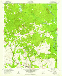
Eastover serves as the focal point for this rural landscape in lower Richland County, situated near the western edge of the Wateree River basin. The area is characterized by a high density of community landmarks, including numerous rural churches such as Daughters of Zion Church, Antioch Church, and Mount Zion Church. The settlement pattern reflects a mid-century agrarian society organized around local schools like Crossroad School and the critical transportation corridor of the Atlantic Coast Line railroad. Further south, the presence of the Richland County Chain Gang Camp No. 1 provides a specific look at local correctional history during the early 1950s. The eastern portion of the map is dominated by the complex wetlands of the Wateree Swamp and Gum Swamp, where names like Cooks Mount rise above the alluvial plains.
Find a feature on this map
37 named features on this map. Tap any name to fly to it.
Don’t see what you’re looking for? This feature index may not catch every label — zoom into the map to look around manually.
Map Details
Editions of this 1953 Eastover Map
4 editions found
Other maps of this area

1935 · Killian
USGS Topo · 1:48,000

1937 · Killian
USGS Topo · 1:62,500

1938 · Hagood
USGS Topo · 1:62,500

1941 · Spartanburg
USGS Topo · 1:250,000

1942 · Camden
USGS Topo · 1:125,000

1943 · Eastover
USGS Topo · 1:62,500

1948 · Hopkins
USGS Topo · 1:62,500

1953 · Messers Pond
USGS Topo · 1:24,000

1953 · Poinsett State Park
USGS Topo · 1:24,000

1953 · Wedgefield
USGS Topo · 1:24,000