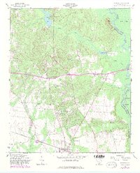
1953 Map of Eastover
USGS Topo · Published 1983About this map
The Seaboard Coast Line railroad runs through the town of Eastover in this mid-century survey of the South Carolina Midlands, where the landscape transitions into the river bottomlands. This area is characterized by a high density of rural institutions, particularly churches such as McLeod Church, Good Hope Church, and Mount Zion Church. The map also captures the Cemetery for the Daughters of Zion Church, providing specific points of interest for genealogists and local historians studying the congregation patterns of the era.
Find a feature on this map
38 named features on this map. Tap any name to fly to it.
Don’t see what you’re looking for? This feature index may not catch every label — zoom into the map to look around manually.
Map Details
Editions of this 1953 Eastover Map
4 editions found
Other maps of this area

1935 · Killian
USGS Topo · 1:48,000

1937 · Killian
USGS Topo · 1:62,500

1938 · Hagood
USGS Topo · 1:62,500

1941 · Spartanburg
USGS Topo · 1:250,000

1942 · Camden
USGS Topo · 1:125,000

1943 · Eastover
USGS Topo · 1:62,500

1948 · Hopkins
USGS Topo · 1:62,500

1953 · Messers Pond
USGS Topo · 1:24,000

1953 · Poinsett State Park
USGS Topo · 1:24,000

1953 · Eastover
USGS Topo · 1:24,000