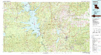
1986 Map of Leesville
USGS Topo · Published 1988About this map
The Toledo Bend Reservoir dominates this mid-1980s landscape, marking the sprawling water boundary between Louisiana and Texas. This massive reservoir system, flanked by the Sabine National Forest and several state recreation areas, indicates a region shaped by major twentieth-century water management and conservation efforts. To the east, the extensive grounds of the Fort Polk Military Reservation and the Peason Ridge State Wildlife Management Area illustrate the significant federal and state footprint on the piney woods of Vernon and Sabine parishes.
Find a feature on this map
97 named features on this map. Tap any name to fly to it.
Don’t see what you’re looking for? This feature index may not catch every label — zoom into the map to look around manually.
Map Details
Editions of this 1986 Leesville Map
This is the sole edition of this map. No revisions or reprints were ever made.
Other maps of this area

1937 · Chopin SW
USGS Topo · 1:31,680

1937 · Chopin NW
USGS Topo · 1:31,680

1937 · Bellwood
USGS Topo · 1:31,680

1937 · Montgomery
USGS Topo · 1:62,500

1937 · Cloutierville
USGS Topo · 1:31,680

1937 · Cypress
USGS Topo · 1:31,680

1941 · Leesville
USGS Topo · 1:62,500

1941 · Zwolle
USGS Topo · 1:62,500

1941 · Slagle
USGS Topo · 1:62,500

1942 · Many
USGS Topo · 1:62,500