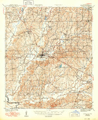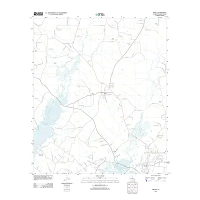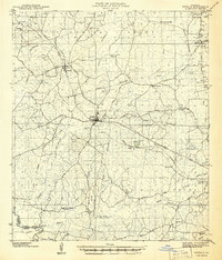
1941 Map of Zwolle
USGS Topo · Published 1941About this map
Zwolle serves as the central hub of this 1941 landscape, where the Kansas City Southern Railroad meets a network of local roads and watercourses. The area is defined by the deep indentations of the San Miguel Bayou and La Nana Bayou, which historically shaped the transport and settlement patterns of this part of Sabine Parish. Local life is anchored by numerous rural institutions, including the San Patricio Ch and Alliance Sch, reflecting a community distributed across small town centers like Noble and Belmont. Along the Sabine River at the southwestern edge, Pattersons Ferry marks a critical historical crossing point into Texas. The presence of several Old Railroad Grade markings and an Old Logging Railroad reveals the significant role of the timber industry in shaping the local geography before the second World War.
Find a feature on this map
50 named features on this map. Tap any name to fly to it.
Don’t see what you’re looking for? This feature index may not catch every label — zoom into the map to look around manually.
Map Details
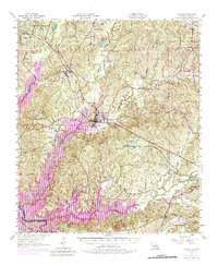
Editions of this 1941 Zwolle Map
This is the sole edition of this map. No revisions or reprints were ever made.
Historical Maps of Many Through Time
10 maps found