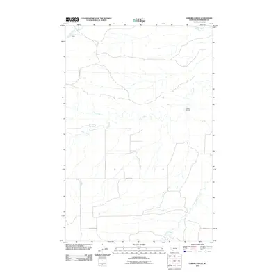
2011 Map of Leiberg Coulee
USGS Topo · Published 2011About this map
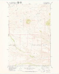
Leiberg Coulee and its surrounding drainages define the landscape of this Judith Basin County map. The area is characterized by a sparse network of county roads and seasonal watercourses, including the central path of Arrow Creek and its tributary Braun Creek. In the northwestern corner, Complimentary Dam sits along Davis Creek, representing a managed water point in this high-plains environment. The map shows a largely rural and open territory, where the physical geography of the coulees dictates the placement of transit routes like County RD-202 and County RD-215. To the southeast, the terrain transitions toward Surprise Creek, illustrating the natural watershed patterns of central Montana.
Find a feature on this map
11 named features on this map. Tap any name to fly to it.
Don’t see what you’re looking for? This feature index may not catch every label — zoom into the map to look around manually.
Map Details
Editions of this 2011 Leiberg Coulee Map
This is the sole edition of this map. No revisions or reprints were ever made.
Other maps of this area

1890 · Fort Benton
USGS Topo · 1:250,000

1892 · Fort Benton
USGS Topo · 1:250,000

1897 · Fort Benton
USGS Topo · 1:250,000

1954 · Great Falls
USGS Topo · 1:250,000

1957 · Great Falls
USGS Topo · 1:250,000

1978 · Leiberg Coulee
USGS Topo · 1:24,000
1978 · Merino
USGS Topo · 1:24,000
1978 · Stanford
USGS Topo · 1:24,000
1979 · Palisade Butte
USGS Topo · 1:24,000
1979 · Jiggs Flat
USGS Topo · 1:24,000