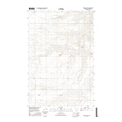
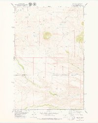
2017 Map of Leiberg Coulee
USGS Topo · Published 2017About this map
Merino Bench dominates the southwest portion of this landscape in Judith Basin County, representing the high, flat plateaus characteristic of this central Montana region. This area is defined by its drainage systems, where Leiberg Coulee and Big Coulee have carved distinct impressions into the terrain. The hydrological network is led by Arrow Cr, which winds through the center of the sheet, supported by smaller tributaries like Davis Cr and Surprise Cr. The settlement pattern reflects a modern rural infrastructure, with a grid of local routes such as Sourdough Rd, Spencer Rd, and Merino Bench Rd providing access to the sprawling agricultural and grazing lands. These roads often follow section lines established by the Public Land Survey System, which remains the primary organizing force for property and navigation in this open country.
Find a feature on this map
20 named features on this map. Tap any name to fly to it.
Don’t see what you’re looking for? This feature index may not catch every label — zoom into the map to look around manually.
Map Details
Editions of this 2017 Leiberg Coulee Map
This is the sole edition of this map. No revisions or reprints were ever made.
Other maps of this area

1890 · Fort Benton
USGS Topo · 1:250,000

1892 · Fort Benton
USGS Topo · 1:250,000

1897 · Fort Benton
USGS Topo · 1:250,000

1954 · Great Falls
USGS Topo · 1:250,000

1957 · Great Falls
USGS Topo · 1:250,000

1978 · Leiberg Coulee
USGS Topo · 1:24,000
1978 · Merino
USGS Topo · 1:24,000
1978 · Stanford
USGS Topo · 1:24,000
1979 · Palisade Butte
USGS Topo · 1:24,000
1979 · Jiggs Flat
USGS Topo · 1:24,000