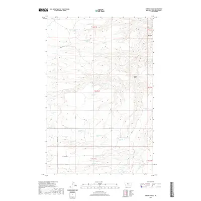
2020 Map of Leiberg Coulee
USGS Topo · Published 2020About this map
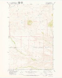
Merino Bench dominates the southern landscape of this central Montana survey, overlooking a network of deep drainage channels and perennial water sources. The terrain is defined by its significant coulees, including Big Coulee in the northeast and the centrally located Leiberg Coulee. Water distribution across this arid environment is marked by numerous identified springs, such as 18N11E21AA__01 Spring and 17N11E12AB__01 Spring, which likely served as vital hubs for local ranching operations. The area is intersected by early ranch-to-market routes like Spencer Rd and Sourdough Rd, which follow the natural contours of the land between the high benches and creek beds. These drainage systems, primarily Arrow Cr and its tributaries like Davis Cr and Braun Cr, illustrate the complex erosion patterns typical of the Judith Basin, where water has carved deep into the limestone and sandstone layers of the plains.
Find a feature on this map
37 named features on this map. Tap any name to fly to it.
Don’t see what you’re looking for? This feature index may not catch every label — zoom into the map to look around manually.
Map Details
Editions of this 2020 Leiberg Coulee Map
This is the sole edition of this map. No revisions or reprints were ever made.
Other maps of this area

1890 · Fort Benton
USGS Topo · 1:250,000

1892 · Fort Benton
USGS Topo · 1:250,000

1897 · Fort Benton
USGS Topo · 1:250,000

1954 · Great Falls
USGS Topo · 1:250,000

1957 · Great Falls
USGS Topo · 1:250,000

1978 · Leiberg Coulee
USGS Topo · 1:24,000
1978 · Merino
USGS Topo · 1:24,000
1978 · Stanford
USGS Topo · 1:24,000
1979 · Palisade Butte
USGS Topo · 1:24,000
1979 · Jiggs Flat
USGS Topo · 1:24,000