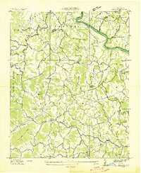
1936 Map of Leicester
USGS Topo · Published 1936About this map
Leicester serves as the focal point of this 1936 survey, where the Leicester School and Alexander School anchor a community defined by its rural mountain valleys. The landscape is carved by the French Broad River and its tributaries, including Sandymush Creek and Newfound Creek. This era captures a transition in Western North Carolina as the Southern railroad follows the river's winding path while the Carolina Power and Light Company transmission line begins to cut across the township lines of Sandy Mush and Leicester. Numerous country churches such as Gudger Chapel and Teague Chapel are scattered throughout the hills, providing clear markers for genealogists tracing family roots near Grassy Knob and the edges of the Pisgah National Forest.
Find a feature on this map
52 named features on this map. Tap any name to fly to it.
Don’t see what you’re looking for? This feature index may not catch every label — zoom into the map to look around manually.
Map Details
Editions of this 1936 Leicester Map
This is the sole edition of this map. No revisions or reprints were ever made.
Other maps of this area

1894 · Asheville
USGS Topo · 1:125,000

1901 · Asheville
USGS Topo · 1:125,000

1935 · Canton
USGS Topo · 1:24,000

1935 · Spring Creek
USGS Topo · 1:24,000

1936 · Marshall
USGS Topo · 1:24,000

1936 · Sandymush
USGS Topo · 1:24,000

1936 · Enka
USGS Topo · 1:24,000

1936 · Weaverville
USGS Topo · 1:24,000

1936 · Mars Hill
USGS Topo · 1:24,000
1936 · Asheville
USGS Topo · 1:24,000