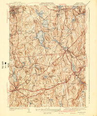
1941 Map of Leicester
USGS Topo · Published 1941About this map
The Clara Barton Home stands near the intersection of Clara Barton Road and Oxford Road, marking the birthplace of the American Red Cross founder. This 1941 survey captures a landscape defined by its complex hydrology and early industrial centers. Settlements such as Spencer, Leicester, and North Oxford are shown during a transitional period, connected by the Boston and Albany RR and the Boston and Worcester Turnpike.
Find a feature on this map
131 named features on this map. Tap any name to fly to it.
Don’t see what you’re looking for? This feature index may not catch every label — zoom into the map to look around manually.
Map Details
Editions of this 1941 Leicester Map
2 editions found
Other maps of this area

1885 · Worcester
USGS Topo · 1:62,500

1886 · Worcester
USGS Topo · 1:62,500

1887 · Brookfield
USGS Topo · 1:62,500

1887 · Barre
USGS Topo · 1:62,500

1889 · Webster
USGS Topo · 1:62,500

1889 · Barre
USGS Topo · 1:62,500

1890 · Brookfield
USGS Topo · 1:62,500

1892 · Webster
USGS Topo · 1:62,500

1892 · Worcester
USGS Topo · 1:62,500

1893 · Brookfield
USGS Topo · 1:62,500