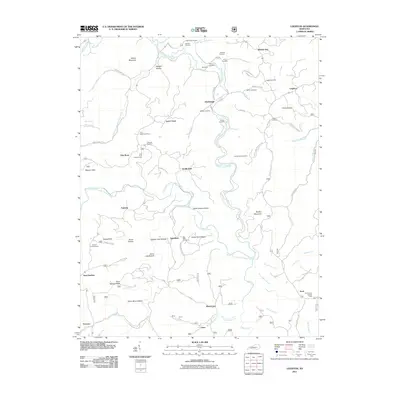
2011 Map of Leighton
USGS Topo · Published 2011About this map
Station Camp Creek and its many tributaries, including South Fork Station Camp Creek, carve a complex network of hollows and ridges through this pocket of Jackson County. The landscape is defined by its high-point surveillance and isolated settlements, with the Drip Rock Lookout Tower and Old Orchard Lookout Tower anchoring the high ground. Local history is deeply etched into the terrain through family-named landmarks like Napper Hollow and Hurd Spring Ridge. Numerous small burial grounds, such as Durbin Cemetery and Callahan Cemetery, are scattered near the winding paths of Jakes Heavenly Hwy and Station Camp Rd. These features, alongside the Drip Rock Post Office and small communities like Alumbaugh and Lynch Town, reflect a long-standing pattern of ridge-and-valley habitation that persists even as modern mapping technology documents the area.
Find a feature on this map
80 named features on this map. Tap any name to fly to it.
Don’t see what you’re looking for? This feature index may not catch every label — zoom into the map to look around manually.
Map Details
Editions of this 2011 Leighton Map
This is the sole edition of this map. No revisions or reprints were ever made.
Other maps of this area

1891 · Manchester
USGS Topo · 1:125,000

1892 · Richmond
USGS Topo · 1:125,000

1892 · Beattyville
USGS Topo · 1:125,000

1893 · London
USGS Topo · 1:125,000

1897 · Richmond
USGS Topo · 1:125,000

1897 · London
USGS Topo · 1:125,000

1952 · Alcorn
USGS Topo · 1:24,000

1952 · Leighton
USGS Topo · 1:24,000

1952 · Cobhill
USGS Topo · 1:24,000

1952 · Heidelberg
USGS Topo · 1:24,000