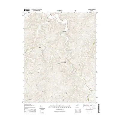
2016 Map of Leighton
USGS Topo · Published 2016About this map
Station Camp Creek winds through the heart of this Appalachian landscape, where the borders of Jackson, Estill, Lee, and Owsley Counties converge. The terrain is characterized by a dense network of hollows and ridges, such as Silver Mine Hollow and Reece Ridge, which have historically dictated the placement of small upland settlements like Leighton and Drip Rock. Much of the central and southern portion of the map is protected within the Daniel Boone National Forest, preserving the wooded character of landmarks like Brushy Mtn and Wind Cave. Local history is preserved in sites like the Sparks Cem near the Estill County line. The distribution of homes and primitive roads follows the natural contours of the land, reflecting a persistent pattern of rural life established long before this modern topographic study.
Find a feature on this map
31 named features on this map. Tap any name to fly to it.
Don’t see what you’re looking for? This feature index may not catch every label — zoom into the map to look around manually.
Map Details
Editions of this 2016 Leighton Map
This is the sole edition of this map. No revisions or reprints were ever made.
Other maps of this area

1891 · Manchester
USGS Topo · 1:125,000

1892 · Richmond
USGS Topo · 1:125,000

1892 · Beattyville
USGS Topo · 1:125,000

1893 · London
USGS Topo · 1:125,000

1897 · Richmond
USGS Topo · 1:125,000

1897 · London
USGS Topo · 1:125,000

1952 · Alcorn
USGS Topo · 1:24,000

1952 · Leighton
USGS Topo · 1:24,000

1952 · Cobhill
USGS Topo · 1:24,000

1952 · Heidelberg
USGS Topo · 1:24,000