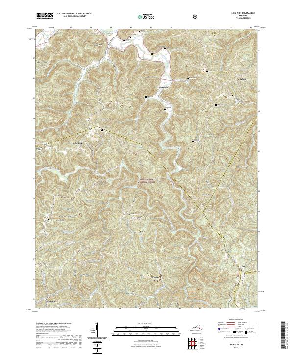
2022 Map of Leighton
USGS Topo · Published 2022About this map
Daniel Boone National Forest encompasses a significant portion of this terrain, where the headwaters of numerous creeks carve through the ridges of Jackson and Estill counties. Local family history is deeply etched into the land through a series of namesake cemeteries such as Callahan Cem, Scrivner Cem 1, and Gabbard Cem, many of which sit on high ground above the hollows. Small communities like Alumbaugh, Drip Rock, and Leighton serve as anchor points for this rural landscape, connected by winding routes like State HWY 1209.
Find a feature on this map
74 named features on this map. Tap any name to fly to it.
Don’t see what you’re looking for? This feature index may not catch every label — zoom into the map to look around manually.
Map Details
Editions of this 2022 Leighton Map
This is the sole edition of this map. No revisions or reprints were ever made.
Other maps of this area

1891 · Manchester
USGS Topo · 1:125,000

1892 · Richmond
USGS Topo · 1:125,000

1892 · Beattyville
USGS Topo · 1:125,000

1893 · London
USGS Topo · 1:125,000

1897 · Richmond
USGS Topo · 1:125,000

1897 · London
USGS Topo · 1:125,000

1952 · Alcorn
USGS Topo · 1:24,000

1952 · Leighton
USGS Topo · 1:24,000

1952 · Cobhill
USGS Topo · 1:24,000

1952 · Heidelberg
USGS Topo · 1:24,000