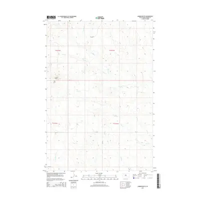
2015 Map of Lemmon Butte
USGS Topo · Published 2015About this map
Lemmon Butte and Hay Butte define the topography of this high plains landscape in Meade County. This 2015 survey by the U.S. Geological Survey shows a drainage network shaped by seasonal watercourses like Johnny Creek and North Brushy Creek, which carve through the terrain as they flow toward the east and south. The land is organized by the Public Land Survey System, with township and range lines like t12n r14e and t11n r15e providing a grid for this sparsely developed ranching country. Local infrastructure is minimal, centered primarily on unpaved routes such as Opal Road and Twilight Place. The map illustrates the characteristic isolation of the western South Dakota prairie, where named landmarks are often defined by prominent buttes and the winding paths of creeks like Middle Creek and East Branch Beaver Dam Creek.
Find a feature on this map
14 named features on this map. Tap any name to fly to it.
Don’t see what you’re looking for? This feature index may not catch every label — zoom into the map to look around manually.
Map Details
Editions of this 2015 Lemmon Butte Map
This is the sole edition of this map. No revisions or reprints were ever made.
Other maps of this area

1952 · Deep Creek SE
USGS Topo · 1:24,000

1952 · Signal Butte
USGS Topo · 1:24,000

1953 · Rapid City
USGS Topo · 1:250,000

1954 · Lemmon
USGS Topo · 1:250,000

1957 · Lemmon
USGS Topo · 1:250,000

1957 · Rapid City
USGS Topo · 1:250,000

1983 · Lemmon Butte
USGS Topo · 1:24,000
1983 · Avance
USGS Topo · 1:24,000
1983 · Opal East
USGS Topo · 1:24,000

1983 · Opal East SW
USGS Topo · 1:24,000